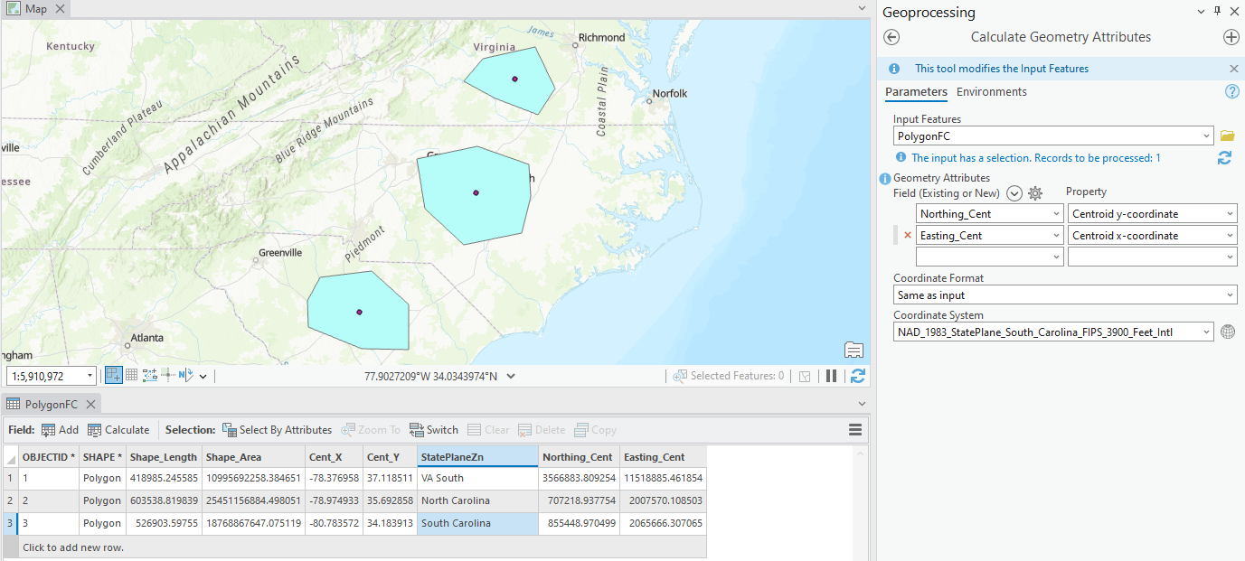
I have a Polygon FC that is in WGS 84, I want to calculate the centroid of the polygon in the respective state plane's northing/easting whenever I draw a new polygon.
Note: The polygons in the image attached are just for show and the polygons would never overlap state planes zones.
Is there a way to automatically do this using attribute rules maybe based off of a field so if I draw a polygon in VA North it auto-populates a state plane field and then gives me the Northing and Easting of said polygon.
I've used the calculate geometry attributes tool before but I need this to be more programmatic and happen automatically when a new polygon is created.
Any ideas?