The performance I'm getting from the Land Cover Classification (Sentinel-2) pretrained model in ArcGIS Pro seems to be well below what it could be. So I would like any help on parameter optimisation for the model.
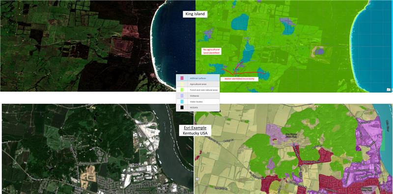
These are my outputs vs. an example from Esri.
On top is an example I'm looking at (King Island). On the bottom is an Esri example from here > Land Cover Classification (arcgis.com). As you can see, the Kind Island example is not identifying much correctly at all, except for the ocean border on the right, It's not identifying any agricultural land, and it's finding water bodies where none exist.
The performance of this model is supposed to be around ~80%, but for King Island the accuracy is much lower with <50% of pixels identified correctly. At the moment the plan is to fine-tune the model with some labelled training data, but I also feel that perhaps the model parameters (padding, batch size, tile size) are not configured properly.
If anybody can point me towards what might be causing this poor performance, or how to improve it, that would be amazing.
Thanks!