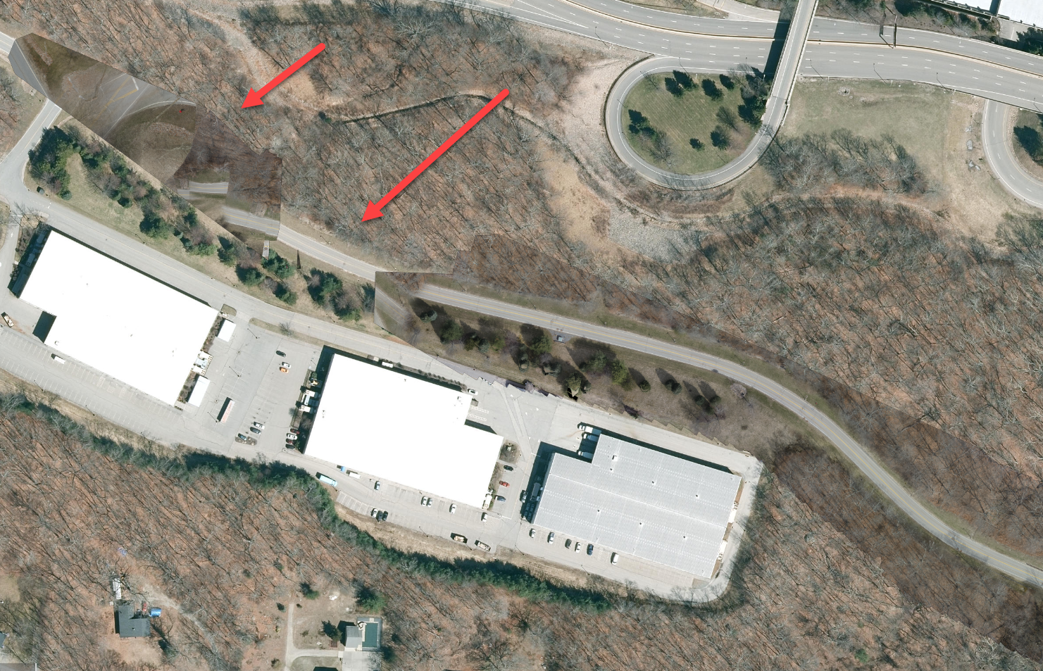
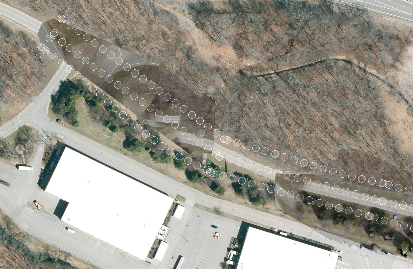
We did a corridor flight with our M300RTK earlier this week and got some weird results when processing in Site Scan. It looks like it skipped a section of the road and where it picked up, the images are all oriented incorrectly. Any thoughts on what could be going on?