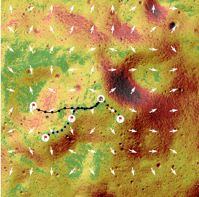
I'm curious to know if and how it's possible to create a slope/altitude profile of a least cost path line. As seen in the screenshot below, I've derived several traverses using the least cost path tool. I've read some information about making profiles using 3D lines, but I don't think it fits what my goals. Anyone have any guidance?
EDIT: I'd like to clarify that my goals are to produce a slope/altirude profile of the least cost path line that looks something like this:
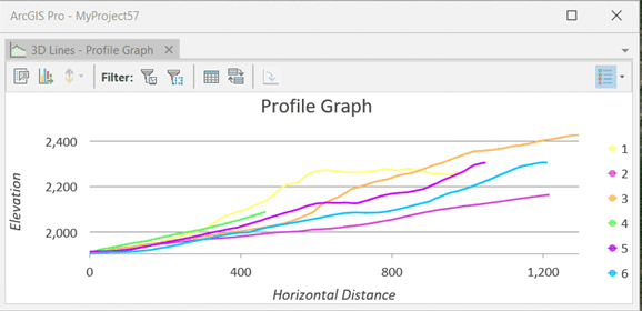
The above graph is what I found in ArcGIS documentation referencing 3D lines.
Thanks,