Hi everyone,
I am trying to map an access easement on ArcPro and I'm having some difficulty getting the curve to behave correctly. The curve data is as follows:
Delta = 98-53-00. R=165, Arc = 284.76, CH= S41-39-35W 250.72
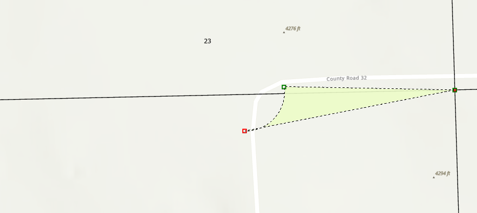
I type in S41-39-35W cb, leave distance blank, 165 for radius, and 250.72 for chord length. However, the curve is going the wrong way. If you look at the screen grab below, it's supposed to follow the curve of County Road 32. Any idea why this would be happening?
Thanks!