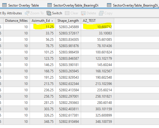
The table below contains the numbers used for direction (decimal degrees) with the Bearing Distance to Lines tool (Azimuth_Ed field) and the result of Calculate Geometry Attributes tool (AZ_Test field).
The tool was run on x,y numbers with state plane, Illinois East coordinate system with that coordinate system set as the output coordinate system.
They don't match. Is this a result of the complex math used to calculate the lines and is expected, or should I be concerned?
Thank you,
Randy McGregor