Hello,
From my DEM, I created the flow direction and flow accumulation raster using ArcHydro Tools
From those 2 rasters, I use the stream definition tool (for a threshold area of 500 pixels for example), then performed the stream segmentation, and finally, I use the Drainage line processing tools to create the vector shapefile of my stream.
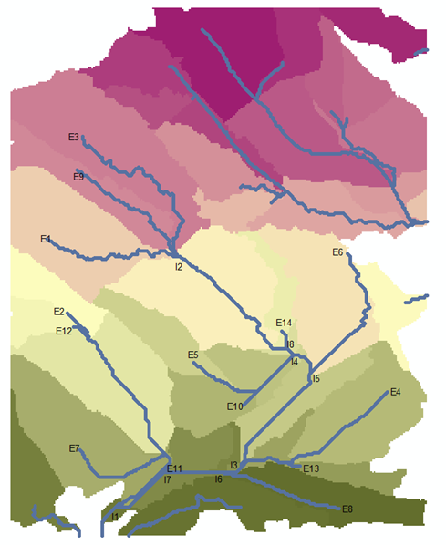
My question: Is there any method to locate the external points of the stream? (I named those points by E in this image)
Any ideas?
(Note: I want to write a script on python for this method, and if the proposed solution demand the use of select by location tools, I will not be able to perform it with a python script)
(I am using ArcGis Desctop 10.8.0.12790)