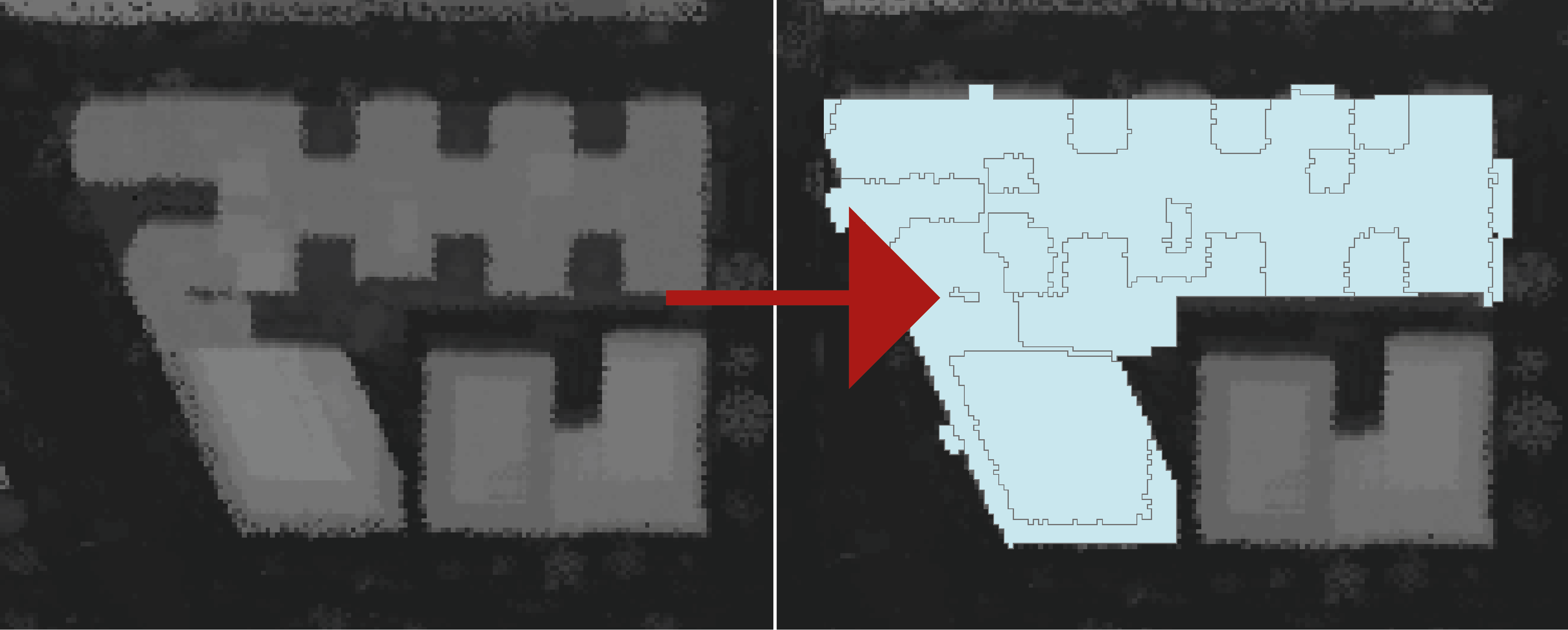
I currently have two layers: building footprints and First Return lidar data. I was able to extract individual building parts through reclassification, but the output-polygon is too pixel-like because of the DWG resolution.
Any ideas on how I can simplify the output to create smooth vector features (i.e. w/ generalized lines and right angles)? I have tried using the 'Regularize Building Footprint' gdp tool, but it does not handle topological errors. I have also tried using the 'Simplify Polygon' tool, but i ends up creating wacky angles.