Hi everyone!
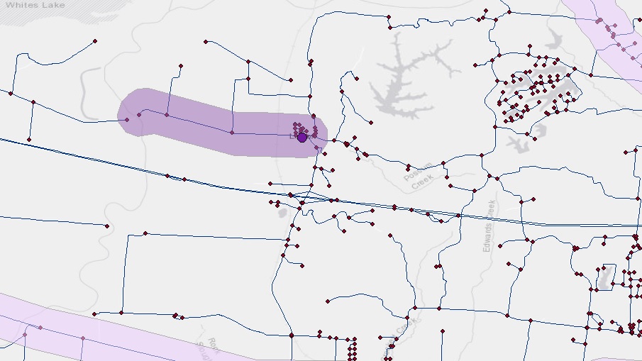
This is the first time I'm getting this problem and I have no idea what is the main problem with it. I'm trying to find 5 km or 10 km service area around emergency stations before and after a flood. But it seems that the ArcGIS prefers to go only on one direction in the road network rather than finding the service area in all possible directions.
I was wondering how can I solve this issue.
Thanks,
Amir