I was wondering if the map that displays in the Inbox page is capable of being interactive, as a way to open the form for the selected feature, and populating the data associated with the selected feature.
Here's my current use case:
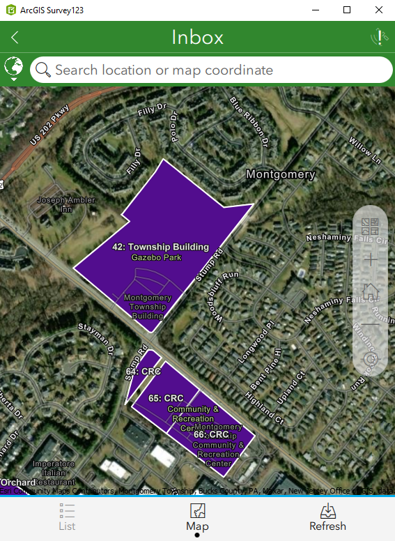
This is a storm water basin inspection form/map. We have dozens of basins, some with confusing numbering, so I have suggested that inspectors reference the map for help determining the number of the basin they're standing at to inspect. I was asked if they'd be able to just click on the polygon in this map tab, rather than going back to the list and searching for the record in the Inbox so they can add their inspection as a repeat/related record.


