This looks like a better right place to ask than where I posted it before: Model Builder / Python Tool Construction: Raster Summation
I'm trying to make a user-friendly tool for a colleague of mine. He would like to be able to ask ArcMap something to the effect of: "I'm going to hike all of X trail to Y canyon and follow Y's creek until it ends. What parts of the mountains will be visible to me along that route. And have it put in the map as a Layer so I can play with several symbolization schemes"
I currently have visibility rasters for every individual trail and creek and they all have the same extent. I can manage to sum any number of these rasters, but only if I know them in advance and use the Raster Calculator to do so. Trying to create a multi-variable list as a model parameter that the end user can input whatever rasters they want is where I run into difficulty.
I came up with 2 different ways to approach this but I hardly know ModelBuilder well enough, and Python hardly at all, in order to do get it to do what I intend it to do:
1. Somehow use the list of rasters to be summed to create a Map Algebra expression?
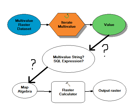
2. Have a kind of looping Plus tool that starts with a blank raster of the same style and adds one of the rasters from the list each time using the previous loop's output as the input? But you can't do that: Error 000670
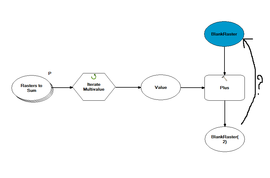
Help!

