Hello Everyone.
I am working on an object detection lab for a GIS class that I teach and am having issues with the process actually detecting objects.
I have followed a number of Esri videos on YouTube and read some of the blogs about the object detection workflow, but it seems that I might be missing something important in my own process, which I have outlined below.
DATA: 2023 USDA NAIP Aerial Imagery
One: Label Objects for Deep Learning (tool)
I originally started with 20 objects and have increased that number to 125.
Two: Export Training Data within the Label Objects for Deep Learning tool
I use the RCNN Masks option for the Meta Data Format
Three: Train Deep Learning Model (tool)
The MaskRCNN model type is automatically inserted and I used 100 Epochs.
Four: Detect Objects Using Deep Learning (tool)
I am including a screenshot of the most recent process.
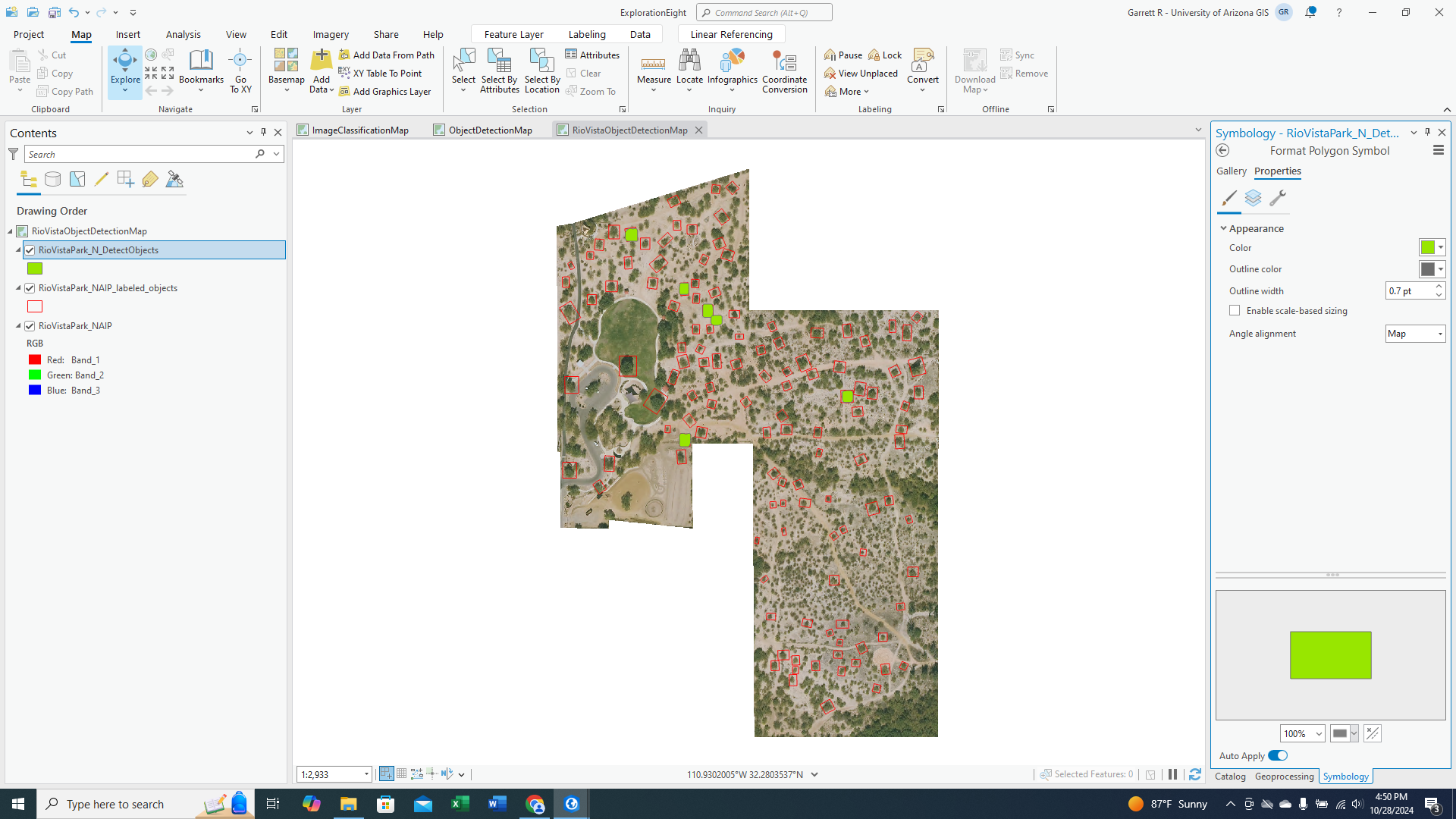
As you can see from the above screenshot, out of 125 training samples it was only able to correctly identify five trees that I trained it to identify and one that was not part of the training dataset.
Is there a strategy to drawing the polygons around the objects that I might be missing in the training phase? I used this video as a reference:
https://www.youtube.com/watch?v=g0FDARaciiI
And the polygons around the boats seem to encompass both the boats and the surrounding water.
Anyhow, I want to show my class this cool technique, but would like it to be more robust than it is currently working.
Thanks for any help, and thank you for reading this post.


