In A GIF: Inset maps you would hang on your wall
- Subscribe to RSS Feed
- Mark as New
- Mark as Read
- Bookmark
- Subscribe
- Printer Friendly Page
- Report Inappropriate Content
Show of hands: Who has been taking screenshots from Google when someone asks for a reference map? Oh wow, everyone raised their hands. What if you could make a reference map that looked like a graphic design masterpiece in almost the same amount of time? Lets make something beautiful in this week's #InAGIF.
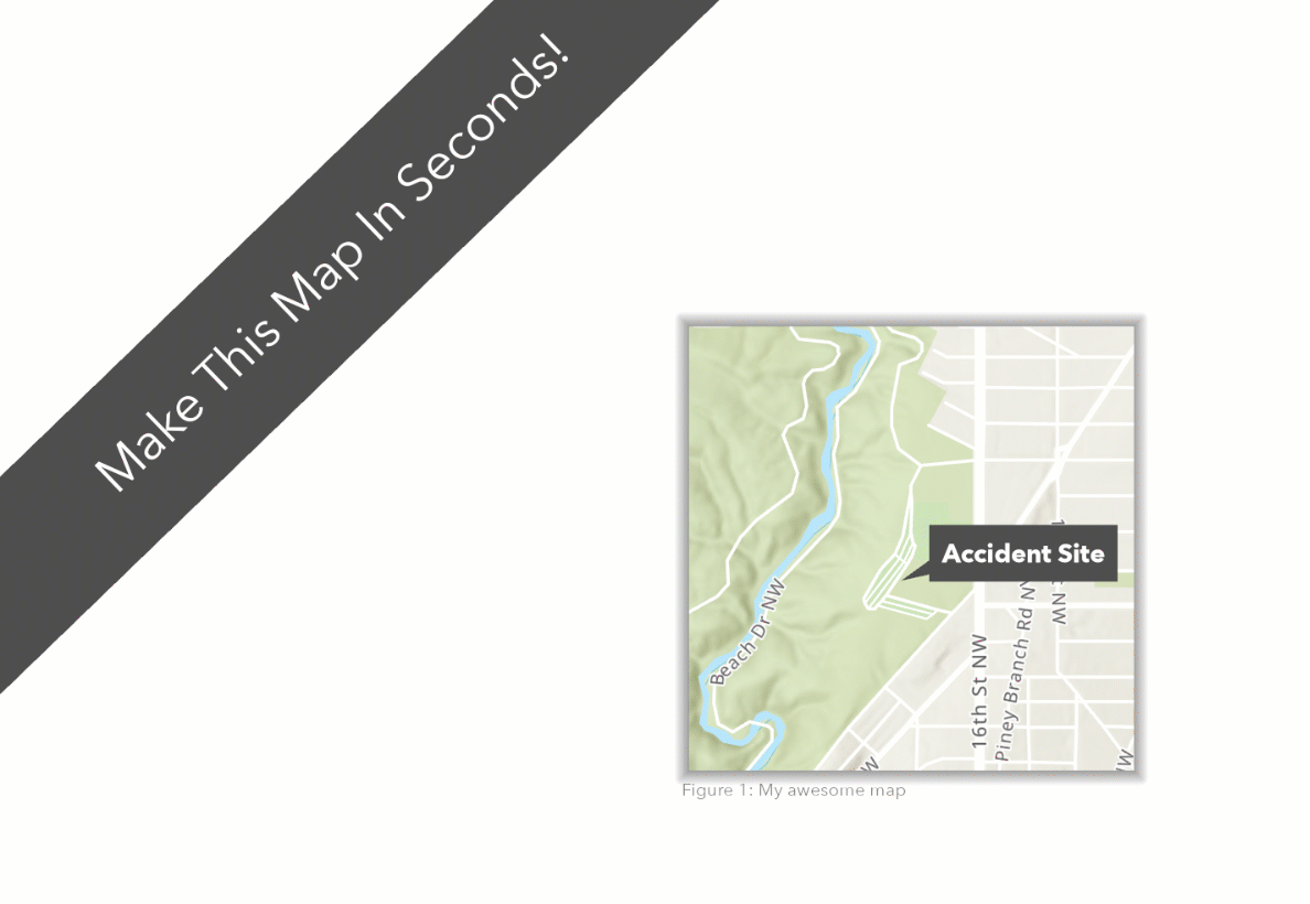
The pièce de résistance here is the option to add a gradient stroke line as the border for a map frame. In this case, I am using a 50% grey fade to 100% white. This presents a shadow illusion in a few clicks. Paired with a pre-generated basemap (one of dozens available for free), we can create a professional-grade map with no graphic design experience.
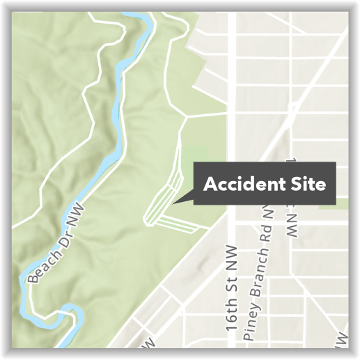
Create this professional-grade inset map in seconds
The interface in this example is ArcGIS Pro, Esri's flagship desktop application. In this environment, you can quickly build incredible maps and products. For this particular example, a single point was added with a balloon label, but you could just as easily have added your own data from an existing spreadsheet.
For more cartographic inspiration on a time-budget, check out John Nelson's One Minute Map Hacks!
About In a GIF:
Every Friday, I take a few seconds of my day to demonstrate a cool feature of the ArcGIS platform, and share it with you all! The goal is to show how easy it is to create incredible products using tools available in the Esri environment.
We've all seen "look how easy this tool is to use" demos before, using curated data and copy-pasta code. So, to truly demonstrate going from zero-to-hero, In a GIF follows three simple rules:
In a GIF Rules: 1) The .gif must be less than 45 seconds. 2) No cutting time from the .gif 3) No pre-prepared code allowed. |
You must be a registered user to add a comment. If you've already registered, sign in. Otherwise, register and sign in.