- Subscribe to RSS Feed
- Mark as New
- Mark as Read
- Bookmark
- Subscribe
- Printer Friendly Page
- Report Inappropriate Content
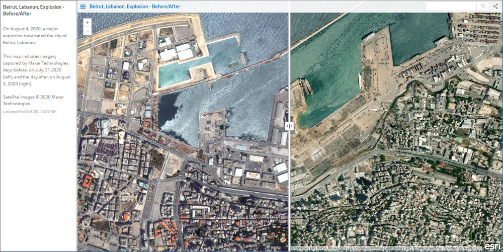
On August 4, 2020, a massive explosion gutted buildings and crumbled neighborhoods surrounding the port of Beirut, Lebanon, after a warehouse containing 2,750 tons of ammonium nitrate ignited. The immediate area, filled with apartments and restaurants, was devastated and the blast was felt more than 100 miles away. As of this post approximately 135 people were killed by the blast, with thousands injured, homeless and hundreds of thousands otherwise impacted in this major tragedy.
Maxar, primary provider of global imagery for the ArcGIS Living Atlas of the World, has published imagery taken on August 5, the day after the blast. This Living Atlas app (made using the Public Information configurable app) shows the before and after imagery.
This imagery helps Esri support disaster response. For more information, visit the Disaster Response Program home.