Turn on suggestions
Auto-suggest helps you quickly narrow down your search results by suggesting possible matches as you type.
Cancel
- Home
- :
- All Communities
- :
- Services
- :
- Esri Technical Support
- :
- Esri Technical Support Blog
- :
- Georeferencing in ArcGIS 10 or “Why is my georefer...
Georeferencing in ArcGIS 10 or “Why is my georeferencing toolbar suddenly grayed out?”
Subscribe
9949
0
02-28-2012 12:13 AM
- Subscribe to RSS Feed
- Mark as New
- Mark as Read
- Bookmark
- Subscribe
- Printer Friendly Page
- Report Inappropriate Content
02-28-2012
12:13 AM
Questions on georeferencing are some of the most common questions that we get in Support. These conversations range from basic how to questions all the way to questions like “Why are the buttons grayed out?”
There are many places you can find georeferencing help. A few of these places are the ArcGIS Desktop Help documentation, the multiple Support Blogs (linked at the bottom), and the technical articles at Esri Support.
Recently, we have been getting a lot of long-time customers using the georeferencing tool calling in because their toolbar is grayed out. If you are having trouble with an inactive toolbar – have no fear! There is a great article that details some of the known issues that can cause problems when georeferencing rasters in ArcMap.
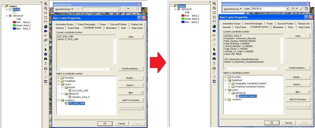
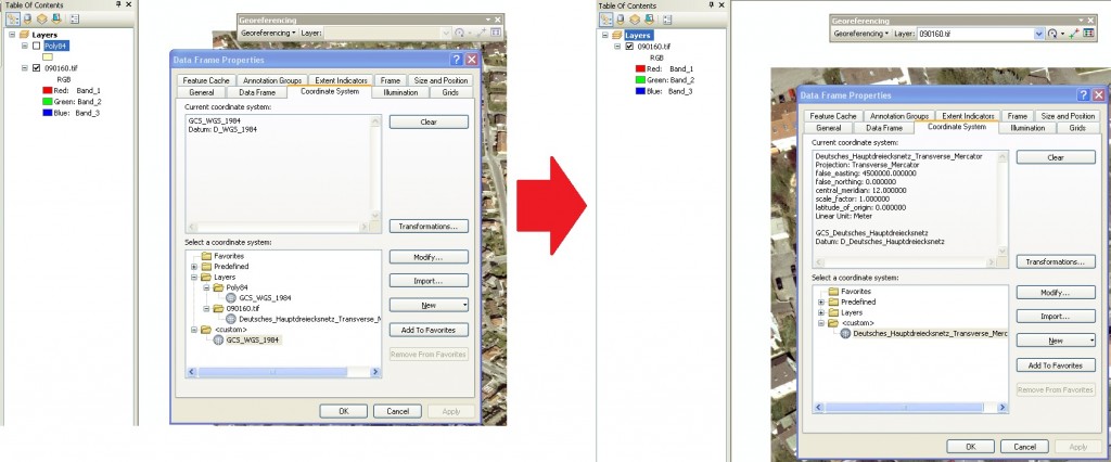
Of the issues described in the article, one of the most common has to do with datum transformations within a map document. When there are layers or rasters in the map document with different datums, the georeferencing toolbar will be grayed out or inactive. To activate the georeferencing toolbar, open a new map document and only add the raster that you desire to georeference.
Always be mindful of which raster you are georeferencing, and always remember to save your solution by rectifying or updating the georeferencing. Otherwise the solution will only be applied to that raster in that map document.Support Blog Posts on GeoreferencingWorking with Rasters: GeoreferencingHaving problems georeferencing your raster image?Jeff S. - Raster Support Analyst
Labels
You must be a registered user to add a comment. If you've already registered, sign in. Otherwise, register and sign in.
About the Author
GIS professional with specialties in rasters, remote sensing, 3D analysis and display, spatial analytics, some python skills and market research. Been with Esri for over 14 years and worked in the industry for over 20 years.
Labels
-
Announcements
70 -
ArcGIS Desktop
87 -
ArcGIS Enterprise
43 -
ArcGIS Mobile
7 -
ArcGIS Online
22 -
ArcGIS Pro
14 -
ArcPad
4 -
ArcSDE
16 -
CityEngine
9 -
Geodatabase
25 -
High Priority
9 -
Location Analytics
4 -
People
3 -
Raster
17 -
SDK
29 -
Support
3 -
Support.Esri.com
60
- « Previous
- Next »

