- Home
- :
- All Communities
- :
- Industries
- :
- Education
- :
- Education Blog
- :
- Developing Ecoliteracy in Primary School with GIS ...
Developing Ecoliteracy in Primary School with GIS and Other Tools
- Subscribe to RSS Feed
- Mark as New
- Mark as Read
- Bookmark
- Subscribe
- Printer Friendly Page
- Report Inappropriate Content
One of the educators I have been working with over the years, Mark Bushman, at Denver Public Schools, works tirelessly to develop ecoliteracy in young students with the use of GIS technology. An example of their work can be seen in the following richly detailed story map, one of the most powerful stories I have ever seen highlighting the work of young students:
https://www.arcgis.com/apps/Cascade/index.html?appid=c314079720964f2c8685e97c81531016
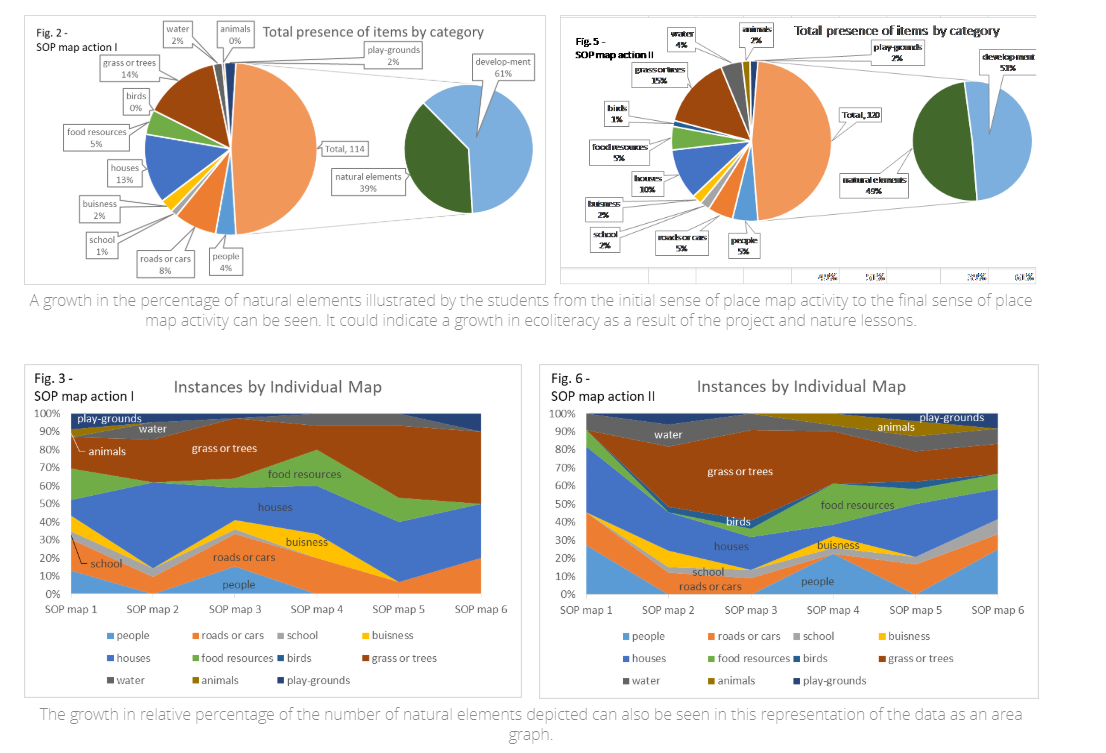
The projects -- most from Grade 2 (8 year-old) students, are fascinating on many levels – (1) They incorporate fieldwork and map trees, birds, and much more; (2) They wonderfully combine art, science, geography, and other subjects. (3) Rather than having to be "busy" the entire duration of the project, they spend time thinking and reflecting. (4) They engage young students in conducting research. (5) They embrace intercultural teaching. (6) They use a combination of tools and develop a variety of skills--GIS, writing, sketching, observing, and much more. (7) The project includes a citizen science component (eBird) and a community service component (building and deploying bird houses). (8) The teacher incorporates the work into a research project with some fascinating findings about the effectiveness of this ecoliteracy project and the utility of using GIS within it.
Upon Mark's invitation, I had the pleasure of visiting this school to teach a workshop on mapping technologies. The students and their teachers whom I met were just as inspiring in person as their story map shows. I salute them and encourage you to consider and incorporate some of what they have done, combining it with your own interests and setting to make these tools and methods work for you.
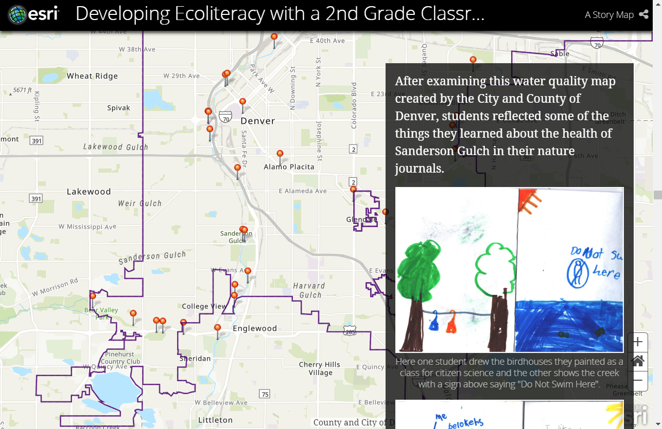
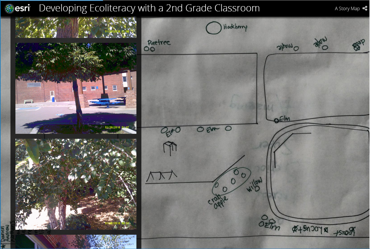
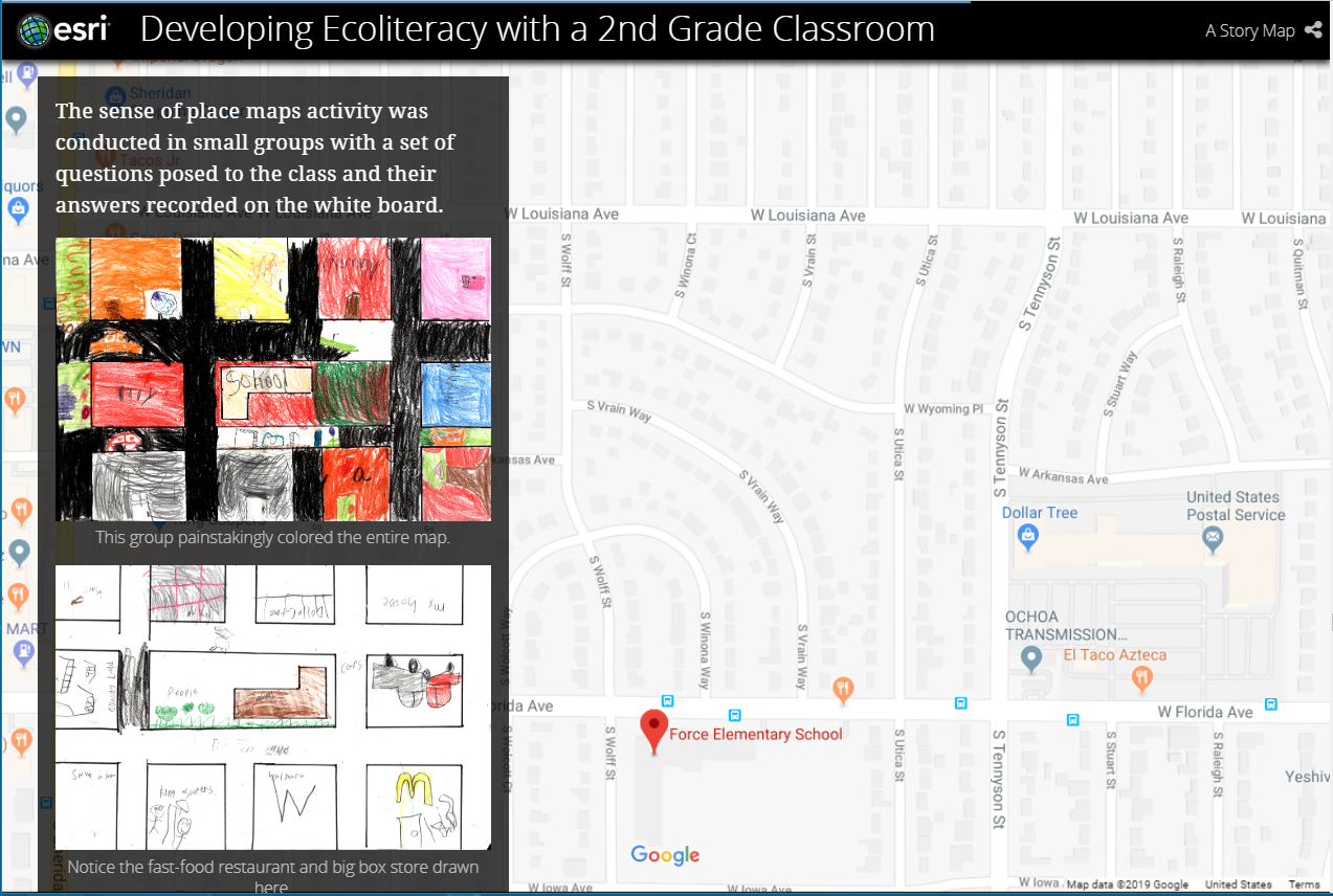
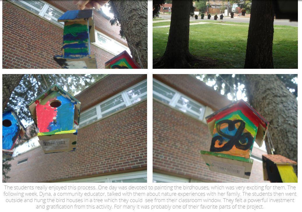
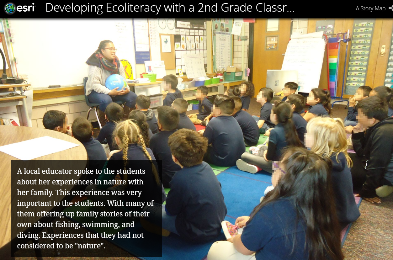
Additional screen shots from the ecoliteracy story map.
You must be a registered user to add a comment. If you've already registered, sign in. Otherwise, register and sign in.
-
Administration
39 -
Announcements
45 -
Career & Tech Ed
1 -
Curriculum-Learning Resources
180 -
Education Facilities
24 -
Events
47 -
GeoInquiries
1 -
Higher Education
520 -
Informal Education
266 -
Licensing Best Practices
47 -
National Geographic MapMaker
17 -
Pedagogy and Education Theory
187 -
Schools (K - 12)
282 -
Schools (K-12)
185 -
Spatial data
24 -
STEM
3 -
Students - Higher Education
232 -
Students - K-12 Schools
86 -
Success Stories
22 -
TeacherDesk
1 -
Tech Tips
83
- « Previous
- Next »