- Home
- :
- All Communities
- :
- Products
- :
- ArcGIS Pro
- :
- ArcGIS Pro Questions
- :
- Re: Importing Control Points for Georeferencing
- Subscribe to RSS Feed
- Mark Topic as New
- Mark Topic as Read
- Float this Topic for Current User
- Bookmark
- Subscribe
- Mute
- Printer Friendly Page
Importing Control Points for Georeferencing
- Mark as New
- Bookmark
- Subscribe
- Mute
- Subscribe to RSS Feed
- Permalink
- Report Inappropriate Content
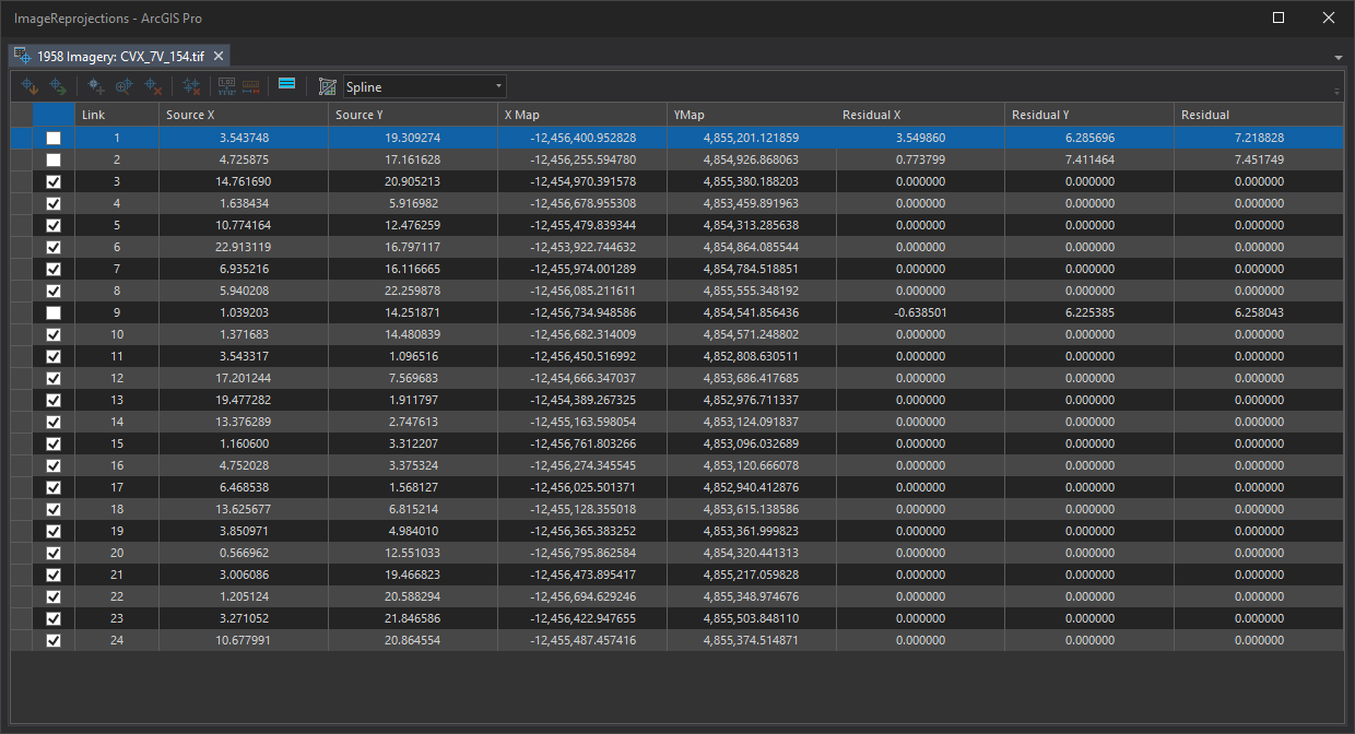
I was georeferencing some an image with the control point table open. ArcGIS Pro siezed up. I took a screenshot of the control point table so I could run and OCR on the image. I parsed the OCR interpretation into a text file hoping I could just import the ground control points. I tried following the format of a known valid exported Control Point files. Unfortunately when I try I get the error message: The input links file is invalid.
I can import other txt files that were created through the Export Control Points button. Here are the first few lines of the txt file. I have tried delimiting with spaces, tabs, and commas.
3.543748 19.309274 -12456400.952828 4855201.121859
4.725875 17.161628 -12456255.594780 4854926.868063
14.761690 20.905213 -12454970.391578 4855380.188203
1.638434 5.916982 -12456678.955308 4853459.891963
attached is the screenshot of the Control Point Table
- Mark as New
- Bookmark
- Subscribe
- Mute
- Subscribe to RSS Feed
- Permalink
- Report Inappropriate Content
I'm having an even worse problem. Ground control points that I generated using auto-georeference in ArcGIS Pro and am trying to import back in again won't even work! They did just earlier today, and the file was not edited. Hopefully someone from ESRI seems this and takes note.
- Mark as New
- Bookmark
- Subscribe
- Mute
- Subscribe to RSS Feed
- Permalink
- Report Inappropriate Content
UPDATE: I'm guessing the files were somehow locked by ArcGIS Pro. Copying the .txt files via File Explorer and attempting to import the copies worked without issue.
- Mark as New
- Bookmark
- Subscribe
- Mute
- Subscribe to RSS Feed
- Permalink
- Report Inappropriate Content
I was having trouble with this error message and opened the control points .txt file in notepad and removed the invisible carriage returns after the last bit of text and that seemed to fix the issue for me.