
Overview
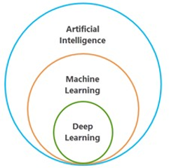
Geospatial AI (sometimes referred to as GeoAI) in ArcGIS is the integration of artificial intelligence (AI), machine learning (ML), and deep learning (DL) with GIS to produce knowledge and solve geographic problems. It is a key part of spatial analysis for tasks related to clustering and pattern detection, prediction and forecasting, and information extraction from imagery, lidar, videos, and unstructured text data.
This guide is for educators who want to use authoritative Esri web-based learning resources as part of college or university courses. Listed items are available as of July 01, 2026, through Esri Academy. This guide is expected to be updated annually. The information provided in this guide is subject to change without notice. New listings are shown in orange.
All items listed are web courses unless otherwise noted. For full descriptions, use the links provided. The complete Esri Academy catalog can be found at esri.com/training/catalog. Please email GIStraining@esri.com or call (800) 447-9778, ext. 5757 with questions about courses.
A learning plan is a set of learning content with a suggested order. You can create your own plan or copy and edit one that you find. You can assign your plan to students or colleagues and track their progress. Go to the Esri Academy Help page (Category: Learning Plans) for more information.
You and your students may be eligible for unlimited access to the entire collection of self-paced e-Learning (web courses, training seminars, and more) if your institution has a qualifying product with a current maintenance subscription. To determine whether this applies to you, contact your Esri software license administrator, check online, or email educationinfo@esri.com.
Geospatial AI
Foundational concepts
The following resources cover foundational concepts of geospatial AI.
- Understanding GeoAI in ArcGIS: Explores how organizations can leverage geospatial AI capabilities across the ArcGIS system to automate workflows, create rich models of the real world, and analyze all kinds of data at scale, including imagery, 2D and 3D features, tabular data, videos, unstructured text, and time-series data. (Training seminar, 1hr.)
- Introduction to AI in ArcGIS: Introduces ArcGIS as a geospatial AI platform and explores how geospatial AI enhances geoprocessing workflows. (1 hr., 5 mins.)
- Metadata Essentials for AI-Ready GIS: Explores metadata’s role as a critical enabler of AI readiness. Introduces techniques to ensure consistent information across the ArcGIS platform and support content governance, discoverability, and appropriate reuse. (Training seminar, 1 hr.)
- Make an Impact with Enterprise GIS: Explores a holistic framework to build and sustain a successful GIS program that powers organizational alignment, efficient operations, smarter decisions, and innovation across your enterprise. (MOOC, 6 weeks; September 9, 2026–October 21, 2026)
Related Learning Plan
Data integrity foundations
The following resources establish data quality as a prerequisite for machine learning and AI outcomes and support input data reliability for machine learning workflows. These resources focus on workflows and tools needed to maintain accurate, consistent, and reliable spatial datasets and introduce methods for managing spatial, attribute, and geometry integrity.
- Maintaining Attribute Data Integrity Using ArcGIS Pro: Provides foundational concepts and workflows for maintaining spatial data integrity in ArcGIS Pro. Covers data accuracy, consistency, quality control, and topology-based editing tools. (Web course, 3 hrs., 5 mins.)
- Maintaining Spatial Data Integrity Using ArcGIS Pro: Introduces workflows for verifying and correcting attribute and geometry errors in ArcGIS Pro. Explains how to address common data inconsistencies to support accurate, reliable spatial datasets. (Web course, 3 hrs.)
Machine Learning
These resources help students understand spatial problem-solving in a wide range of application areas, from image classification to spatial pattern detection to multivariate prediction.
Cluster identification
The following resources introduce concepts, skills, and tools that allow you to analyze where clusters exist.
Related Learning Plan
Esri Tutorials
Geostatistical interpolation
The following resources teach ArcGIS Pro interpolation workflows to create prediction surfaces.
Related Learning Plan
Image classification
The following resources introduce powerful image classification and object detection workflows. Get an overview of the capabilities at Image Analysis and AI.
Related Learning Plan
Regression analysis
The following resources introduce the power of regression analysis in modeling, examining, and exploring spatial relationships.
Related Learning Plan
Deep Learning
The following resources help students build skills in deep learning, a subset of machine learning that uses several layers of algorithms in the form of neural networks.
Related Learning Plan
Esri Tutorials
- Extract informal settlements with SAMLoRA (Esri Tutorial, 45 mins.)
- Extract high-resolution land cover with GeoAI (Esri Tutorial, 30 mins.)
- Train a model using automated deep learning (Esri Tutorial, 40 mins.)
- Map floods with SAR data and deep learning (Esri Tutorial, 45 mins.)
- Detect objects with Text SAM (Esri Tutorial, 25 mins.)
- Detect objects with a deep learning pretrained model (Esri Tutorial, 20 mins.)
- Get ready for deep learning in ArcGIS Pro (Esri Tutorial, 15 mins.)
- Improve a deep learning model with transfer learning (Esri Tutorial, 1 hr., 30 mins.)
- Identify infrastructure at risk of landslides in ArcGIS Pro (Esri Tutorial, 1 hr.)
- Classify power lines using deep learning (Esri Tutorial, 1 hr., 30 mins.)
- Classify mangroves using deep learning (Esri Tutorial, 1 hr., 15 mins.)
- Train a model to identify street signs (Esri Tutorial, 1 hr.)
- Try geospatial AI tools and models in ArcGIS (Esri Tutorial series)
Final thoughts for educators
You can view lists of new training, training pending retirement, and retired training on the New and Retired Training Options page on Esri Academy. You will receive a message when retirements are announced. (Click to view alerts while signed in to Training.)
If you plan to assign a MOOC to a group of students or to an entire class, please review the following resources:
To request a transfer of training history from an institutional account to another account, students should contact Esri Customer Service at service@esri.com or (888) 377-4575.
Geospatial AI guide URL
The published guide can be accessed with the following link:
https://www.esri.com/training/assets/downloads/Higher_Ed_Guide_Esri_Geospatial_AI.pdf
