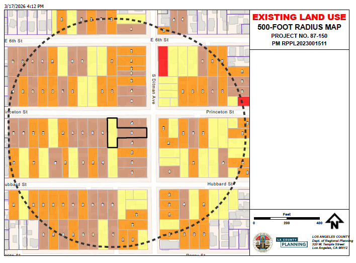
I created a custom print service on a stand-alone server that's used in my ArcGIS JS SDK app (in beta): Clustering - query clusters | Sample | ArcGIS Maps SDK for JavaScript. Users can zoom all the way in and select a parcel in the map. Then they can click a popup action to create some layers.
Only issue now is the legend. I wasn’t sure how I would get the legend to come through prior to creating the service. After creating it (Task: Export Web Map), I’m still not sure (fyi-legend does show using the default print utility).
Not sure if this code needs to be adjusted or it just isn't possible. Does anyone else know?
const print = new Print({
  view: view,
  printServiceUrl: "https://rpgis.isd.lacounty.gov/arcgis/rest/services/ExportWebMap/GPServer/Export%20Web%20Map",
  templateOptions: {
    title: "EXISTING LAND USE",
    format: "pdf",
    layout: "Landscape_8.5x11_LU_Map", // Ensure you use a layout template, not MAP_ONLY
	attributionEnabled: false,
	dynamicLegendEnabled: true
  }
});