I am using ArcGIS 10.4.1 and Network Analyst. I am facing an issue when trying to connect segments with different elevation values. In the image below we can see a segment of a tunnel and its attribute table. It has a a value of -1 for LayerElev field(field marked yellow).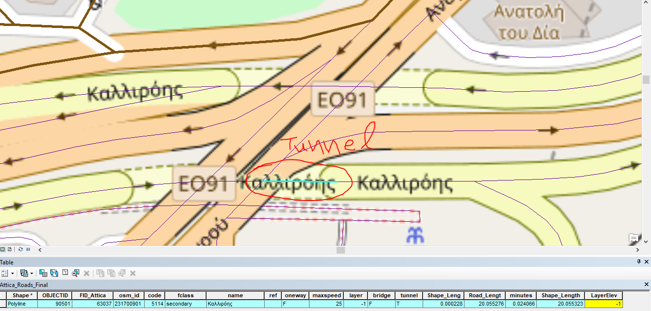
But the next segment is not a tunnel so it has a a value of 0 for LayerElev field(field marked yellow).
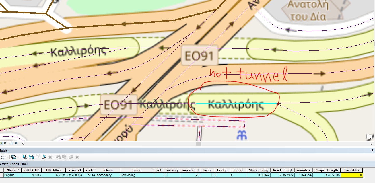
What is the proper way to connect those to segments? Do i have to create 2 fields in the attribute table (from endpoint and to endpoint) instead of the one i 've got now?
I have to use elevation because the area has complicated junctions with overpasses, underpasses and tunnels.


