All,
Normally I use the geo-processing tools to complete the following task but I thought I would give the raster functions ago as they appear to be a quicker and smarter way of doing thinks, but I failed at the first hurdle!
I have a DEM and I want to set all negative elevation values to NODATA, typically I would use the Set Null tool to achieve this.
So I started to create a raster function (see screen shot below) but I cannot work out how to complete this apparently simple task.
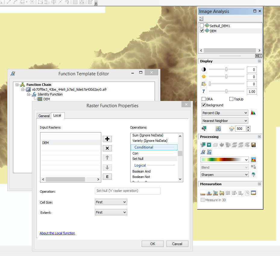
How do you complete the dialog to say "value < 0". I'm not understanding what the greyed out operation box is telling me? For example if one was to write this in python it would be:
outSetNull = SetNull("elevation", "elevation", "VALUE < 0")
Would someone post a screen shot of how to run the local function Set Null as a Raster Function?



