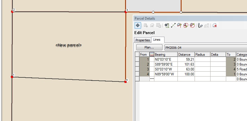
Here's a video showing my issue. I've tried it on a different PC and did not get different results. Note the use of the parcel measurement button.
https://youtu.be/xkJKrGN0CSY
I've been heavily involved in migrating our parcels to the parcel fabric. In effort to teach myself to construct the fabric from scratch, I've been following the workflow for adding a new subdivision. I'm able to input the subdivision boundary without any issues. My problems come when it's time to construct from parent and use breaklines to add parcel corners. It seems that the breaklines do not land where they need to be, resulting in incorrect linework when constructed. I assume you must construct your line with the parcel measurement view button selected, meaning the parcel is in its original state prior to being joined. Is this correct?
In the image below, the north boundary is broken were required and the west boundary is broken at 63 feet. Upon the traverse of the road frontage, I head south 63 feet from point 8 to 12 and then head west 100 feet to point 9 from 12. As you can see, there is a major issue with alignment at point 9. When I measure the distance between points 4 and 9, I get about 59 feet, which is wrong, even though I typed in the correct breakline measurement
Any input as to why this is happening would be greatly appreciated. I've been struggling for days trying to figure out why this is happening. To temporarily fix my problem, I've been drawing the maps as a separate feature and then using the subdivision from CAD workflow to get my lines into fabric.
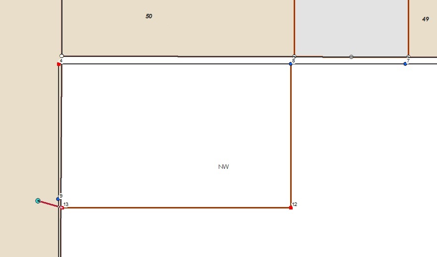
Here's the end result, note the incorrect measure 59.xyz which was broken at 63.