Hi All,
I have a data driven map at approx 150 pages, and each page shows a land parcel, and on each land parcel we can have several buildings.
So land parcels is a polygon with a SITE_ID
Buildings is point feature class with a BUILDING_ID and a SITE_ID which is a key between the two.
I have done a data driven booklet based on each site, and it shows the buildings within and their building ID.
I want to add to each page an index showing each of the buildings shown, and the building name (so people can identify at a glance each building).
My first question, is this possible?
My second question, is there a tutorial somewhere?
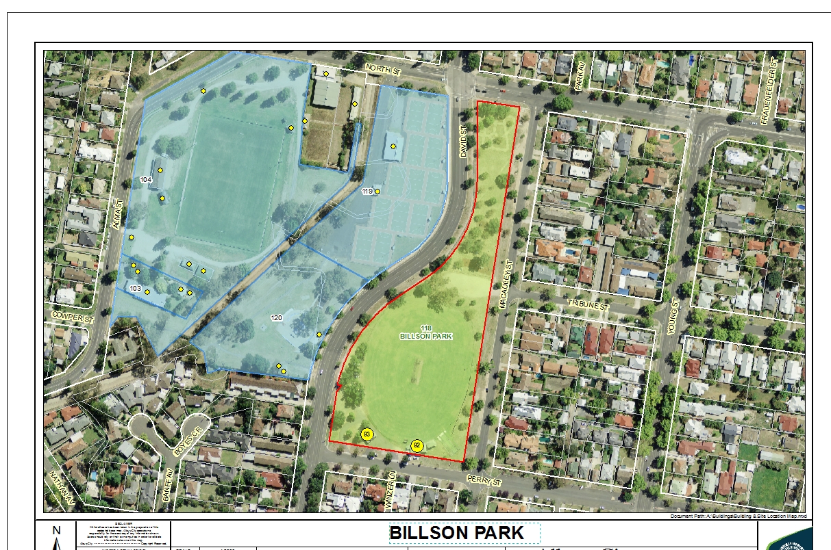
Added image, yellow site is data driven site, and yellow dot with numbers are buildings with same site ID as data driven site Message was edited by: Ben Van Kesteren



