Hi,
I want to solve Vehicle Routing Problem for school services. There are 357 students and 30 different starting point for each driver. And finally they will be reached to "one" school.
As i see here:
Plan Routes—ArcGIS Online Help | ArcGIS
"Many starting points and one ending point"
I loaded my whole data as csv format. There are students, starting points and school as end point.
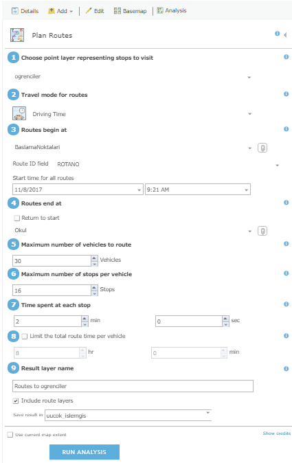
I wrote the informations about picture, as again:
In this image, I choose "students"(students) point layer representing stops to visit, Routes begin at "Starting Points"(Baslama Noktalari), RouteID Field is not important but i select RotaNo, Routes end at "school"(okul), Maximum number of vehicles to route = 30. Because there are 30 starting points and i think this value must be equal to sum of starting points. Maximum number of stops per vehicle = 16. I think this value must be capacity of a vehicle.. And i think like that. Time spent at stop = 2 minutes. I choosed "include route layers" and unchecked "use current map extend".
I couldn't solve the problem. I made maybe 30 analysis consumed so many credits but no result.
May you show a path? How can i solve the problem?
I even tried RoutePlanner. But it seems it can't solve vrp even it was considered as extending of arclogistics.


