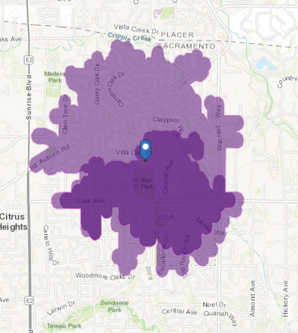
Estou usando o ArcGIS Online para criar mapas de tempo de caminhada do DriveTime. A maioria parece razoável, mas um deles está incorreto. O resultado é a camada de feições em https://allisondan.maps.arcgis.com/home/item.html?id=0d1b0526de694658b657e7c50aae93a1 . A área mais escura é o contorno do percurso a pé de 20 minutos usando um ponto de busca por endereço, enquanto a área mais clara é o contorno do percurso a pé de 20 minutos usando um ponto carregado. Os locais são os mesmos — dá para ver que coincidem no mapa; a análise pelo endereço está claramente incorreta, enquanto a análise com o ponto carregado parece razoável. Alguma ideia?
I was finally able to access the webmap and that allowed me to determine why you were getting different results.
The two walk time polygons are created from a slightly different starting point. For any given point, the tool needs to find the point that is closest to the street network, and then the tool calculates how far it can travel in 20 minutes from the starting point on the street.
For your analysis, because the two starting points are slightly different, they end up being located on different portions of the street network and so produce different results.
In the screenshot below one of the polygons is created from the magenta colored point which ends up being located on Villa Oak Dr (since that is the closest location from that point). The green colored point ends up being located on the walking path in the park.
The green colored point is able to travel a lot less number of streets in 20 minutes as compared to the magenta colored point resulting in different walk time polygons.
Hope this helps
Deelesh
Hi Dan,
If I click on the link to open the web map, it asks me to sign into your ArcGIS Online organization. In order for me to look at the web map, can you make sure your web map is shared with "everyone"?
Thanks
Done. I’m new to ArcGIS Online, have been using ArcGIS Pro so I forget about things.
~~
Dan Allison
I am still getting prompted for credentials when I click the web map link.
Hmm. It says it is shared with everyone. How about this short URL?
https://arcg.is/1XP098
Thank you! I understand what you are saying. The ironic thing is that I got the green point from an address search in ArcGIS online, which is for a school that sits on Villa Oak, while the magenta point is from my GPS mapping app, Motion-X GPS. I’ll need to re-create my origin points as the front door of the school.
Membros conectados podem postar, seguir atualizações e mais. Novo aqui? Registre uma conta gratuita.
Find useful guides, FAQs, and documents to help you navigate and make the most of Esri Community.