
The ArcGIS for Excel 2026.2.0.0.70 update incorporates a range of new features, including notifications for successful edits, label filtering, and the ability to apply rendered color styling within both the map and Excel workbook. This version delivers substantial enhancements to the Time Slider, Measurement Widget, and Selection Tools. These updates are specifically designed to strengthen your current workflows and introduce advanced functionality aimed at improving overall productivity.
New features
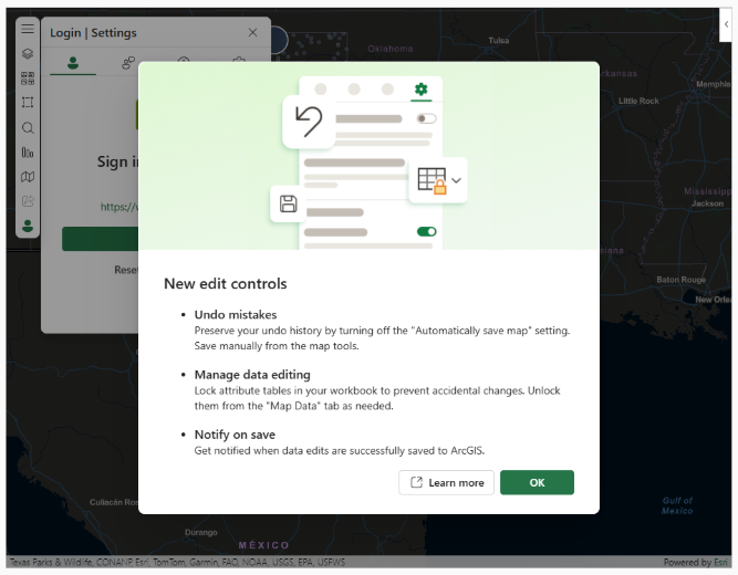
ArcGIS for Excel provides data edit controls and supports the Undo capability to help prevent accidental edits to feature layers and give you more control over when changes are saved.
1. In an Excel spreadsheet, locate and click the ArcGIS tab.
2. Click Show Map.
3. Add data from ArcGIS.
4. Click the Map Data tab.
5. Click the Manage Editing button for Manage Editing to use the Lock Data Unlock or Unlock Data Lock capabilities. When the edits to feature service data are done, they are explicitly controlled.
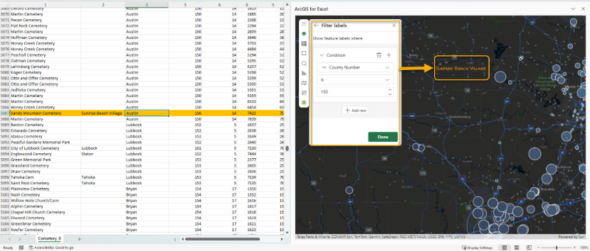
Add support for Layer label filtering
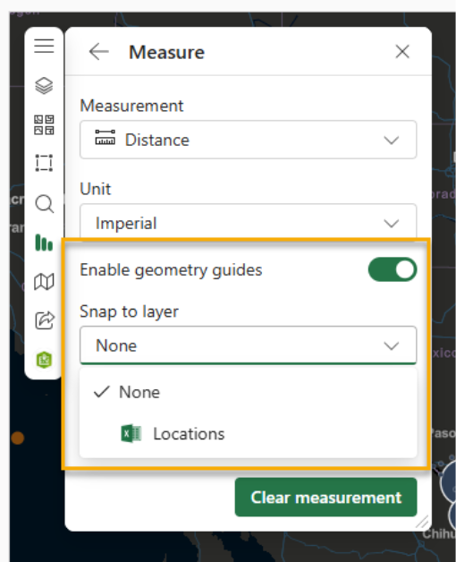
Feature snapping in the Measurement Widget
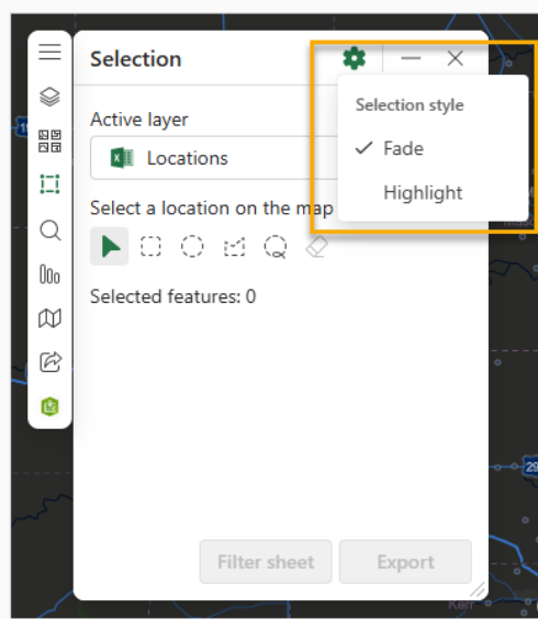
Selection tools option for fade/halo selected display
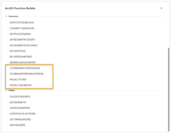
Expand ArcGIS functions with geometry service
To include: PROJECTPOINT, PROJECTGEOMETRY, COORDINATETONOTATION, COORDINATEFROMNOTATION
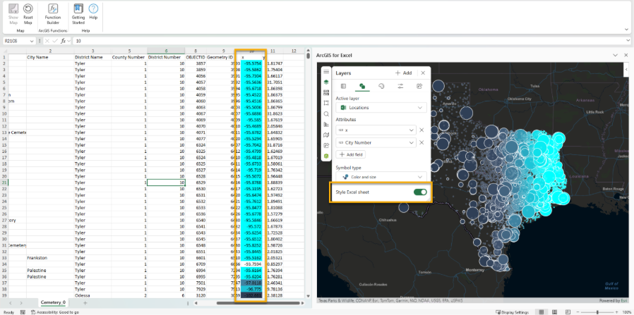
Apply renderer color styling to worksheet data and the map
Enhancements
- ENH-000182921 Enhance the time slider in ArcGIS for Excel by providing more options to configure it
- Improve performance for Spatial filtering for use centroid
- Displays a message that edit was made successfully
- Spatial Filter tool should work with Filtered data
- Implement What's new edit controls notifications
Fixed bugs
- BUG-000179503 When publishing hosted feature layers to ArcGIS Online or portal, the field names do not use column headers and instead are automatically generated names such as 'FIELD_NAME_A'.
- Using ENRICHBYPOINT function does not persist in country when selecting a blank cell.
- BUG-000183791 Updating a previously shared map or a layer fails with the error [Database error has occurred].
- Using Function Builder will change cell references by switching between sheets.
- Using Sync operation disabled automatic map window from opening.
- The sign-in Lock Icons shows sub-layers after the parent layer is unlocked.
- BUG-000185274 Related and hosted tables cannot be synchronized.
- #VALUE error using excel short cut to select large count of rows in Function builder.
Quality of Mapping
The user interface is now more intuitive and user-friendly. Translation issues are fixed, error messages are clearer, and new icons are updated.
Till next time
Please explore these enhancements and share your feedback. My office is open, so feel free to send success stories to scardoza@esri.com.
Sign up to join our Early Adopter Community and bring the power of mapping into your presentations using ArcGIS for PowerPoint.
