The ArcGIS for Excel 2025.2.0.0.46 release offers new features including geometry drawing, the ability to add single or multiple rows of data to an ArcGIS layer, support for JSON files with Z and M values, new custom and Geoenrichment functions, and interaction with database tables published on the ArcGIS Platform and added to an ArcGIS for Excel worksheet.
Several bugs have been fixed, enhancing cell selection and refreshing operations in the user interface.
New features
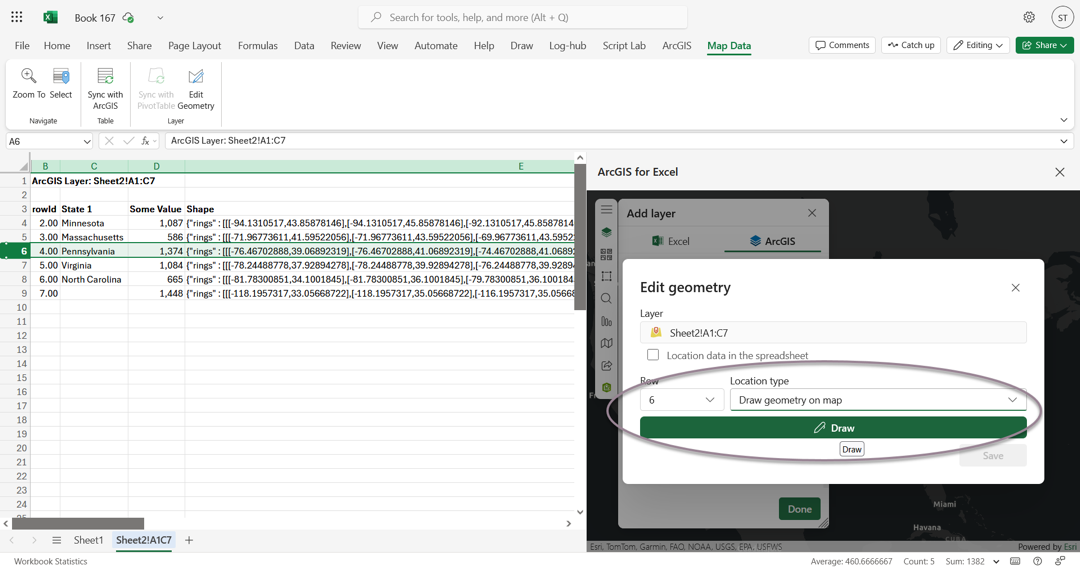
1. We have added the capability to draw or edit geometry:
 2. You can now add or edit database tables from non-hosted services
- Access and interact with Database tables that are published on the ArcGIS Platform and added to an ArcGIS for Excel worksheet.
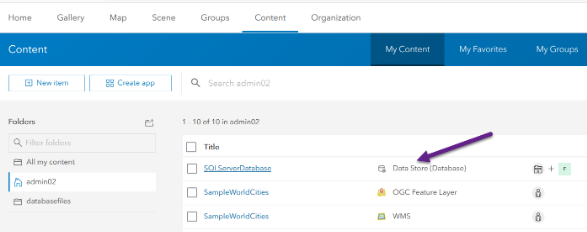
Example above SQL Server Database
3. We have introduced several new custom calculation functions:
- GETPOLYGONAREA – calculate the area of a polygon
- GETGEOMETRYLENGHT – retrieve the length of geometry (perimeter or circumference).
- GETCENTROID – calculate the centroid for geometry.
- GETGEOMETRYDISTANCE - calculate the geodesic or planar distance between two geometries
- RELATEGEOMETRIES – compare a geometry to another geometry by performing a spatial relationship operation.
- GENERALIZEGEOMETRY – generalize geometry using Douglas-Peucker algorithm
Finally, two new Geo Enrichment functions have been added:
- ENRICHBYPOLYGON – provides information about people, places or businesses in an area.
- GETGEOMETRY - accepts the name of a country or state as input and returns in Geo-JSON.
Enhancements
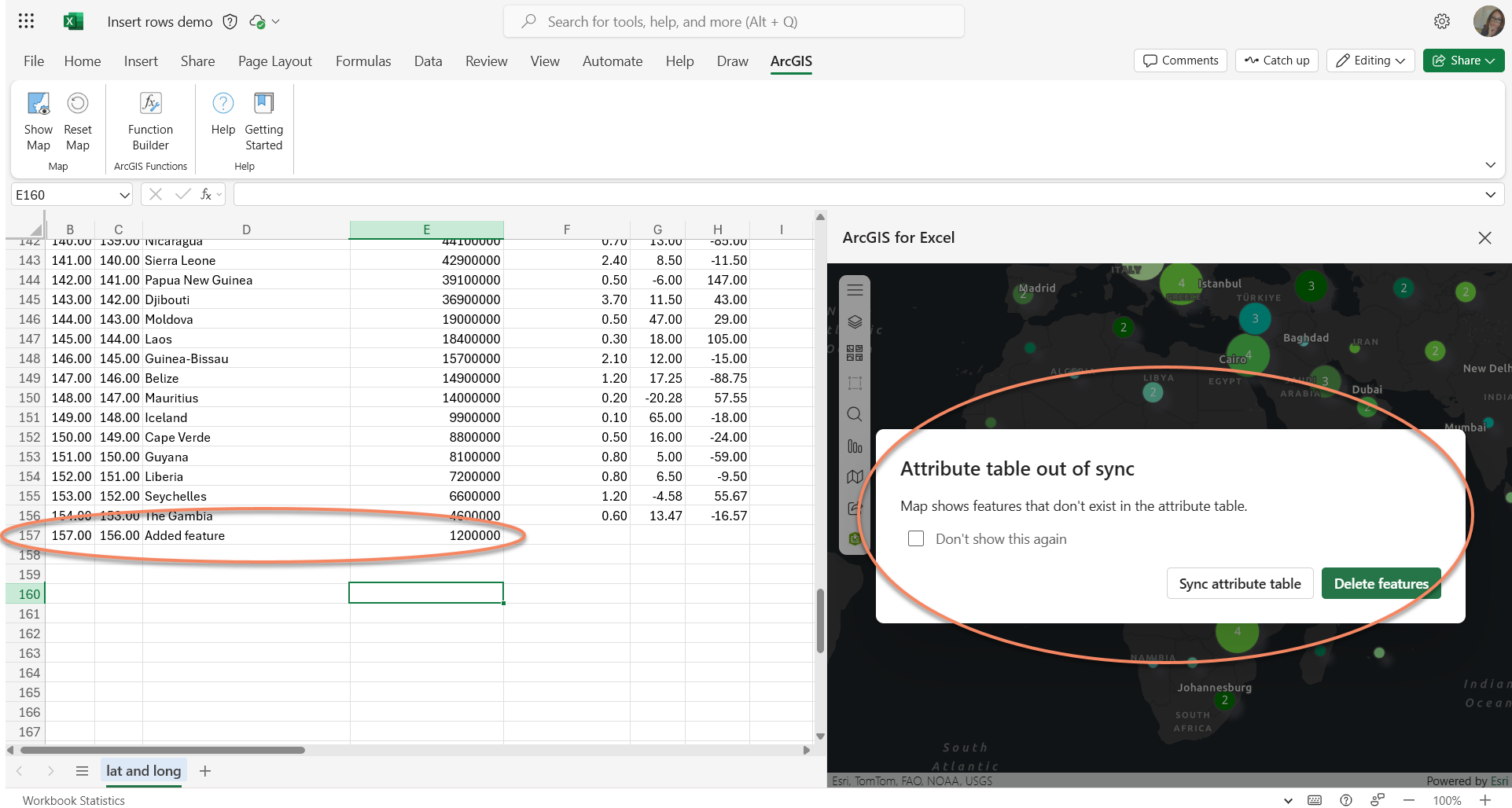
1. When adding data to an ArcGIS layer, you can now include insert single or multiple rows of data.
Once a row is entered, you may complete your Excel worksheet and sync your edits.
2. Support JSON files containing Z and M values.
Fixed bugs
- BUG-000174746 Using an Excel sheet layer as the "Layer to filter" in the Create Spatial Filter tab causes an error: "You don't have access to this resource."
- BUG-000164342 Inconsistent behavior with the refresh button in ArcGIS for Excel.
- Undefined errors when adding JSON file.
- Coded values were not filtered correctly.
- The spatial filter tool encounters an issue when saving the result to an ArcGIS Enterprise organization.
- Truncated text when using the ‘i’ icon for Information tools
- The buffer analysis does not retrieve 1000 zip codes.
- Resolved multiple issues in the Offline environment
Quality of Mapping
The user interface is now more intuitive and user-friendly. The optimized layout allows easier access to key functions, reducing the learning curve for beginners, and boosting productivity for experts.
- Resolved several translation and localization issues
Till next time
We encourage you to explore these enhancements and are eager to receive your feedback. With that said, my office is open! I encourage you to send me your success stories. My email is scardoza@esri.com.
