Hi Esri Community,
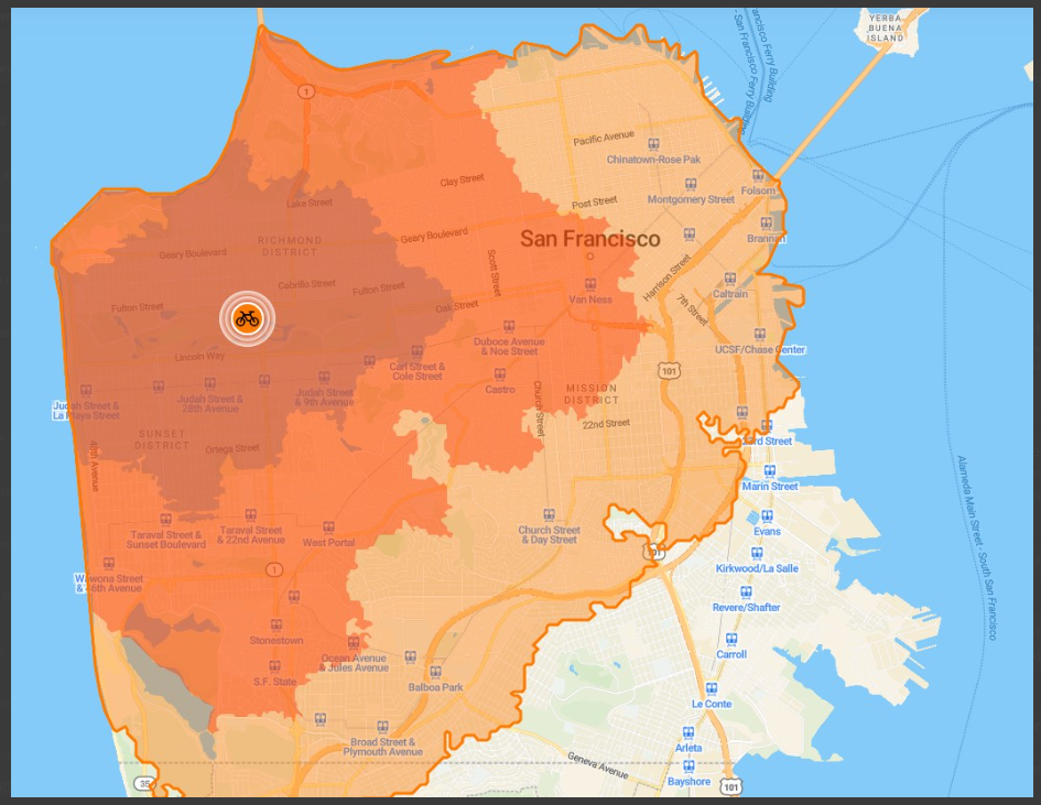
I'm envisioning a service area map showing the bike ride times from 15, 30, and 45 minutes away to a given location in San Francisco. I want to make this using Network Analyst and incorporate SFMTA bike route data and I would add the travel mode "Bike Time".
I'm not sure how to integrate the bike network data when building the network dataset for this and there are many parameters that I'm uncertain about. I don't even know if the bike route data has the attributes necessary for creating a network dataset.
I was thinking about simplifying the analysis by just creating the "Bike Time" travel mode, using the ArcGIS Pro integrated network dataset, and making it the average speed of someone commuting by bike, but then I got to thinking about how this likely oversimplifies the results because bikers will avoid hills and streets that don't have designated bike lanes (the bike network data).
Does anyone have any suggestions on how to approach this?
The end goal is a bikeshed map (service area) that shows the areas in SF that are within a certain bike time to the given destination.
This example below is of a result I created using an interactive map tool. I want to recreate this using network analyst.
Please let me know what you think. Thank you!