In our app we'd like to display information at multiple points along a flight path.
The end result should look something like this where the blue line is the flight path, the black crosses are the points of interest, and the blue triangle the plane itself with an info box that displays its current state, for example altitude, speed etc. The boxes are connected / anchored to their respective locations.
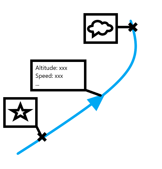
I've read quite a bit about Callouts and Popups but I'm not sure they're the right approach. With callouts for example the MapView Class | ArcGIS Maps SDK for Qt | Esri Developer only has a single calloutData property, so we would not be able to render more than 1 info box at a time.
MarkerSymbol Class | ArcGIS Maps SDK for Qt | Esri Developer has OffsetX and OffsetY properties. With that we can get an info box symbol to the correct place with an offset relative to the location. But how could we draw the line or "leader" that connects the offset box and the location? MarkerSymbol has leaderOffsetX, leaderOffsetY properties, but I'm not sure how to even draw this leader...
We're also using a custom dictionary style to render some of our symbols. Is there any way we could define such an info box with a leader in our dictionary style? I saw that the CIM spec has some Callout symbols defined (see CIMCompositeCallout cim-spec/docs/v3/CIMSymbols.md at main · Esri/cim-spec (github.com)) but so far I don't know how I could create such a symbol and use it as part of our dictionary style.

