I am trying to Add 360 images to Oriented Imagery Catalog I created in ArcGIS Pro. The images don’t have metadata attached so I used frame table which contains the following fields.

I used default values for Terrestrial 360 Camera parameters such as Camera Heading, Peach, Roll and distances. After running the tool, the Exposure Points are filled with new values of Camera Heading, Peach, Roll, Horizontal and Vertical Field Of view.....

when Selection OI location , the 360 image opens and camera locations are displayed. But the images are tilted about 90 degrees and the image stiches are completely wrong leading to a loss of a small part of the image(see screenshot below). Camera locations are floating to the sky instead of the direction of the movement( images are taken from a camera mounted on top of a car).
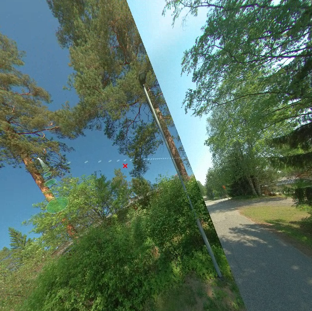
Has anyone faced a problem like this? Could the problem be the orientation values ( Omega Phi Kappa) I used?




