Hello All,
I am following the tutorial here to Display X/Y data from a CSV file containing the lat and long for the point's locations
https://pro.arcgis.com/en/pro-app/latest/get-started/create-points-from-a-table.htm
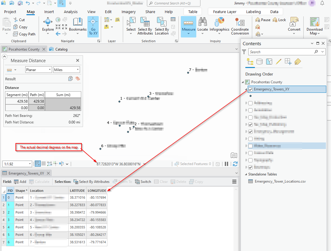
It creates a new layer with the correct lat and long in the attribute table, but the points are not appearing at the correct lat and long on the map. These coordinates should be in Pocahontas County, West Virginia, but they are putting them about 450 miles SW closer to Hopkinsville Kentucky.
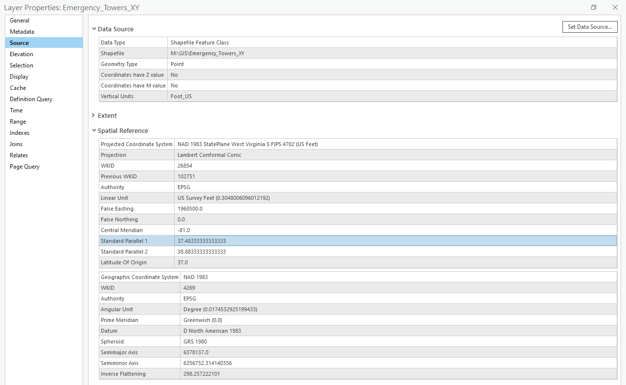
The layer's projected coordinate system appears correct and matches that of my map project. Am I doing something wrong or is this a glitch in the software? I am using ArcGIS Pro 3.1.2 Standard License.
See screenshot for further explanation.