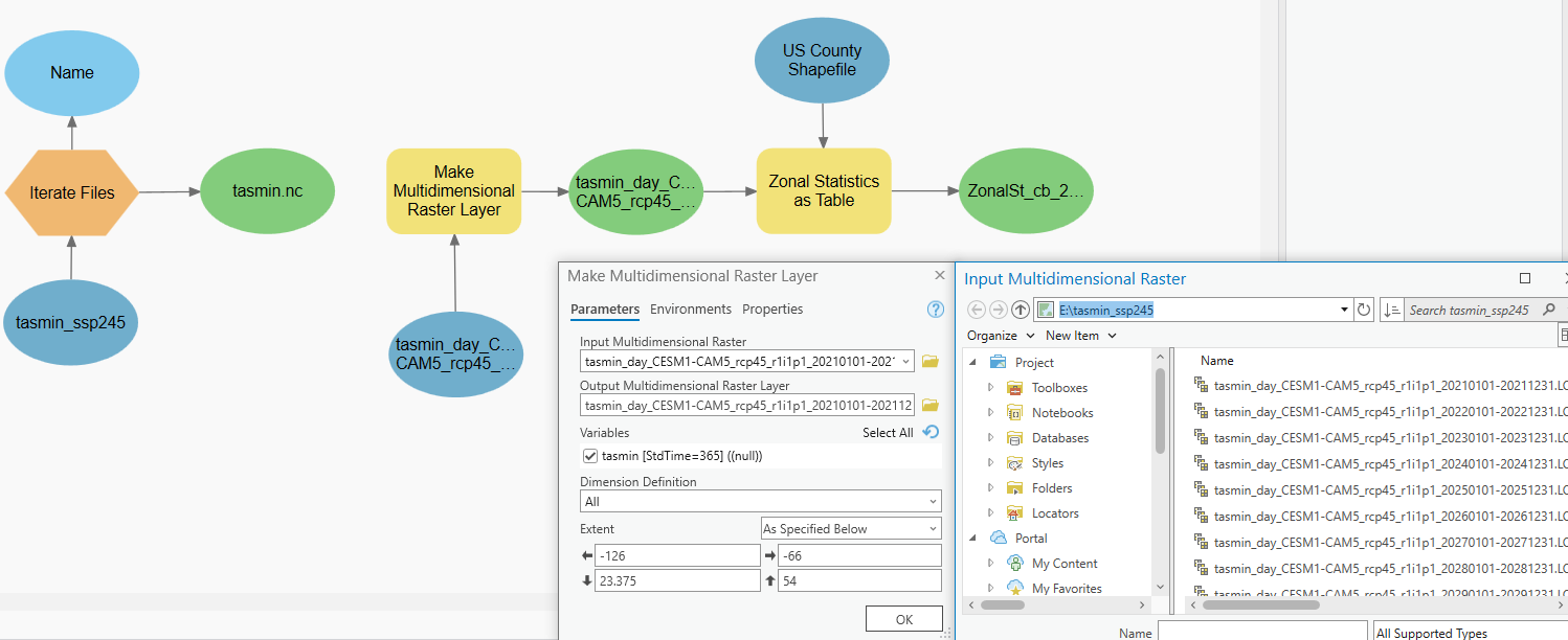
I am running into the same issue as this user did on StackOverflow:
Incorporating Add Data step in ModelBuilder for ArcGIS Pro to create multidimensional raster from NetCDF file - Geographic Information Systems Stack Exchange
I have dozens of NetCDF files that have weather data as their variable, with dimensions of (lat,lon,date). I want to load these as mutlidimensional raster files into ArcGIS's ModelBuilder, if possible. I can do this manually with no issue by going to Add Data > Multidimensional Raster Layer in the Map tab. There is no way to do this in the ModelBuilder utility that I can see. Can anyone recommend a workaround to save me some time?
Edit: I am trying to use this tool in ModelBuilder:
Make NetCDF Raster Layer (Multidimension)—ArcGIS Pro | Documentation
Iterate Files (ModelBuilder)—ArcGIS Pro | Documentation
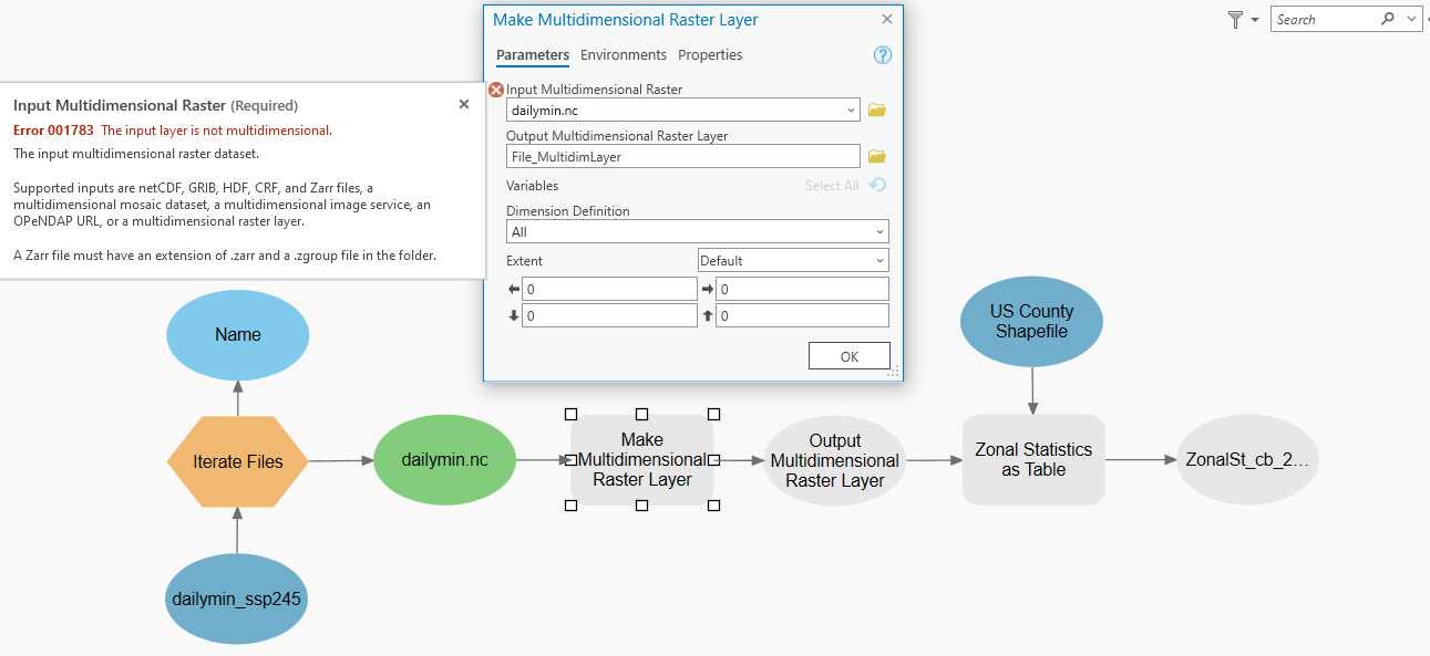
I am using the Iterate Files tool to load in all of the NetCDF files from a directory, but the Make Multidimension Raster tool does not recognize these files as multidimensional when directed as an input to the multidimensional raster.
When I manually select a file in the same directory in the Make Multidimension Raster tool directly, then they all populate and work flawlessly.
Below: Iterate File puts out only NETCDF files. Make Multidimension Raster tool does not accept it.
Now when I instead select an input raster directly from the same directory, the command works flawlessly.