I find that maps rendered from Geodatabase do not look or behave the same way as it looks in ArcMap. This has been a point of frustration for our customers who are building their runtime content. I understand that the differences is expected because the map is rendered from two different engines, but the inconsistency and lack of documentation on these differences is frustrating.
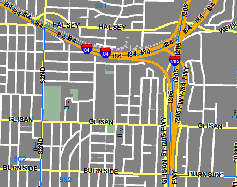
Here is a map seen in Arcmap.
And here is the same map displayed at the same scale in ArcGIS Runtime.
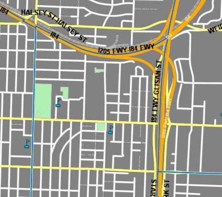
Note the following:
- The freeway emblem does not show up.
- The white shadow behind the black text is not there.
- The label placement property is not observed (I've configured to duplicate labels - one per feature)
Is there any documentation on what is supported and what is not?


