I am interested in being able to change the vertical exaggeration of the map surface, so that elevation data is scaled. I'd like to be able to provide a scaling factor, and scale the vertical axis by that value, and also be able to change that exaggeration scaling factor for the same elevation data source.
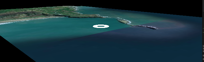
For example, using an exaggeration scaling factor of 5, I'd want to visualize elevation data as if the altitude at each point was 5x higher. So starting with the following, with no exaggeration:
After applying an exaggeration scaling factor of 5, it should look more like:
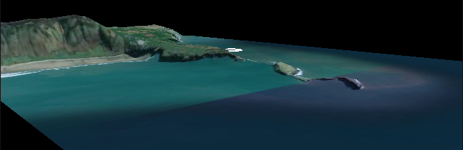
The way I implemented it to get the screenshots above, I tried scaling the `ArcGISMap` transform's Y-component, and initially it looked fine like in the screenshots. However, based on some other threads, it sounds like changing the ArcGISMap transform scale is not really supported. I started seeing some issues like tiles becoming disconnected after experimenting with this and changing the map origin position a bit:
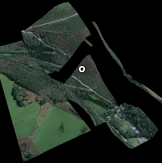
Another approach I've considered is doing it in a vertex shader, however I can't find a way to use a custom map tile material.
So what I'm looking for is a more robust way I might be able to achieve the exaggerated elevation effect I'm aiming for.
Thanks!


