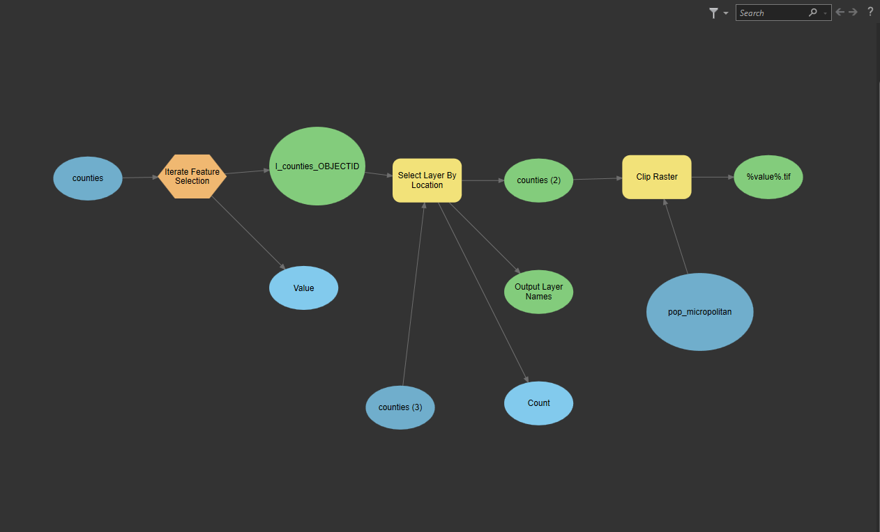
I want to clip the USA population into individual rasters with counties boundaries as output extent. First, I want to select a county, then use select by location to select all the boundary touching counties. I want these selected features as the clipping extent of the output raster. The output is saved as the objectID of the initially selected county.
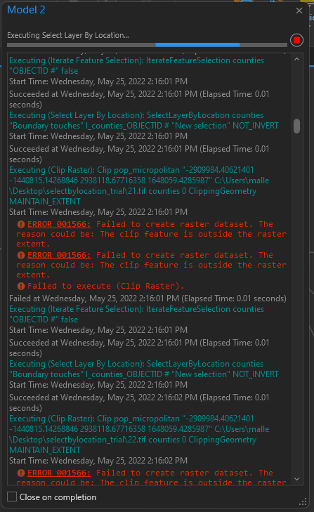
I used model builder, but I've problems. I'm successfully able to generate a raster for 1st county. But for the rest all, I'm getting errors. I've attached the pictures. Please help me.