This issue was observed when attempting to plot census blocks using EsriJSON polygon coordinates in the Location field well. Block number (GEOID20) 510411009382007 is not visible on the map in the below screenshot:
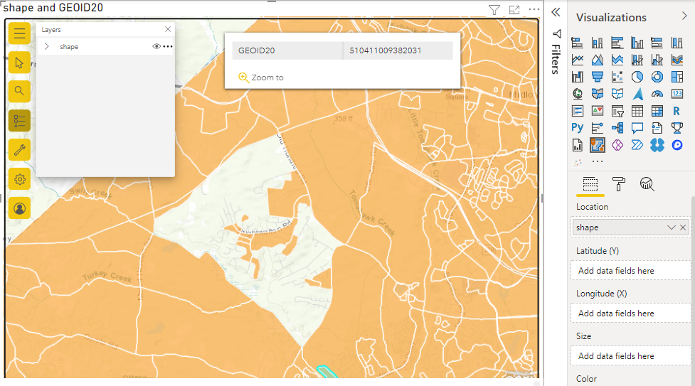
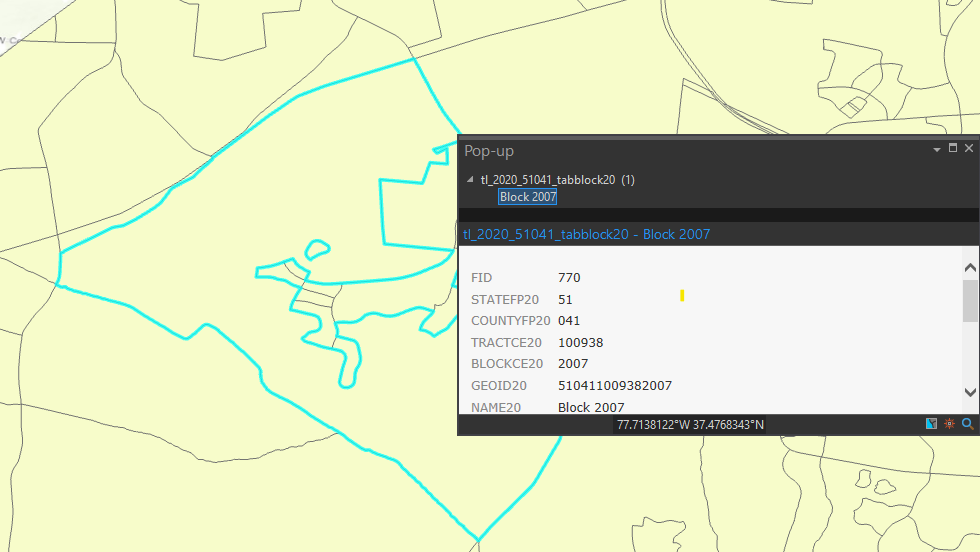
In ArcGIS Pro, the polygon displays correctly, however, this screenshot was taken while using the original Census shapefile before export to esrijson format. This leads me to believe that the issue is likely related to incorrect/invalid geometry formatting in the shape field. Also worth noting that this particular polygon does appear to have an "island" within it.
I have attached the full csv file (non-sensitive data) being used in PowerBI for this example. Columns included are GEOID20 and shape.
PowerBI Version: 2.104.702.0 64-bit (April 2022)




