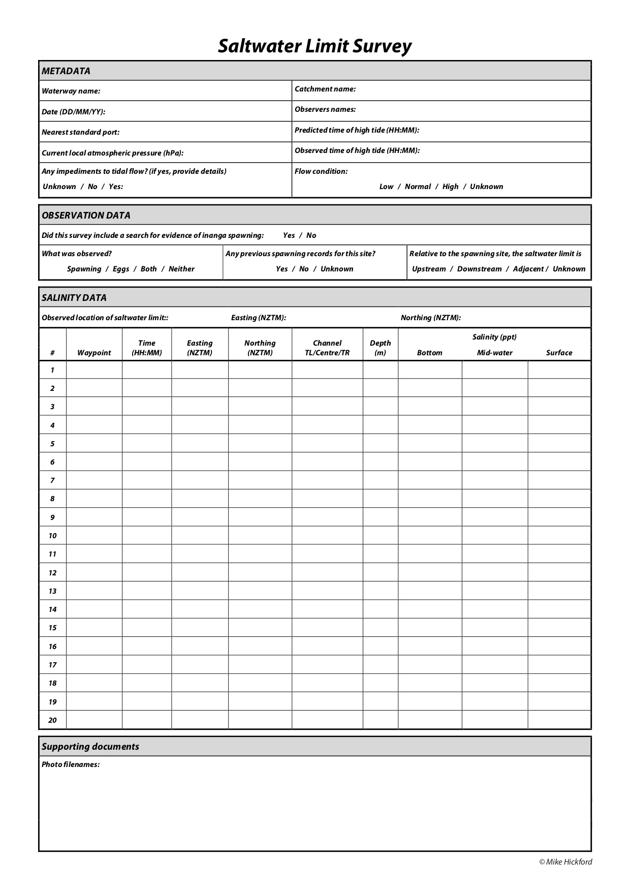
I would like to recreate this paper form in Field Maps (minus any 'location' easting/northing questions).
Each entry of the 'SALINITY DATA' section will be a separate point on the map.
How can I make it that the 'METADATA' and 'OBSERVATION DATA' sections are completed only once by the surveyor, rather than every time a new 'SALINITY DATA' point is created?