Hi all,
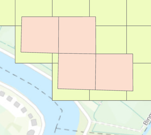
I want to align two vector shapefiles that both are represented by 100m by 100m cells. Thereby, the pink cells have to be placed on the green/yellow cells (see picture below).
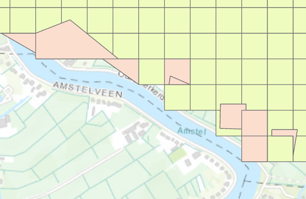
I already executed the "align features"-tool with different search distances (10m, 100m, 500m, 1000m) but the output is incorrectly aligned (see picture below). Therefore, I wonder how the two vector shapefiles can be aligned correctly.
I used the same Geographic coordinate systems (GRS_1980_IUGG_1980_Lambert_Azimuthal_Equal_Area) for the two shapefiles and the basemap.
Thanks in advance!

