I have a map which has a layer symbolized in proportional circles based on the value of a certain field. This layer is a Feature Layer (hosted, view) that is the result of a join with a table that is also on the map. I have a script in python that updates the table that makes the join so that the data from this symbolized layer is also updated. So far, so good.
The problem is: whenever the data is updated, the symbology does not update automatically. The upper bound of the highest value class falls below the current highest value, causing this point not to be symbolized. See the print below to better understand, observing the values in the map and in the symbology classes. As you can see one point was updated to the value 195,505 which is out of the range of the actual symbology (which in turn doesn't update automatically):
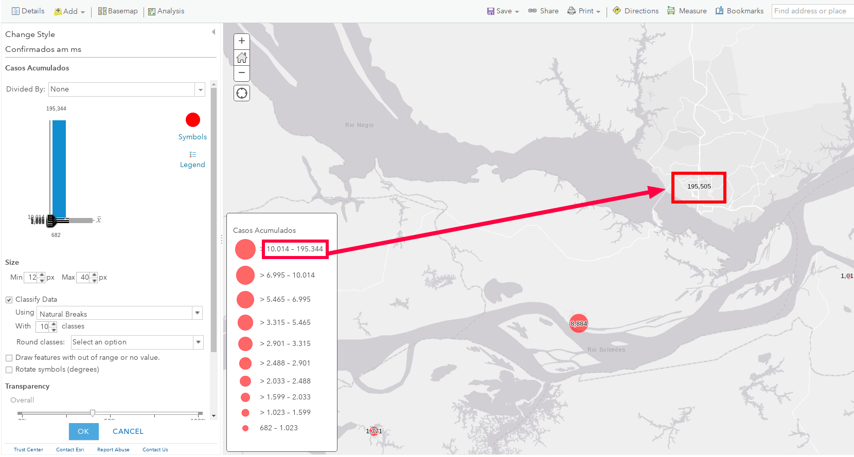
What I manually do in AGOL is decrease or increase the number of classes and then get back to 10 classes. Thus the classes' limits are updated I save the map and I'm good to go. How can I do it via python API?
The entire process is automatic via Python API and I would like to also update the symbology in my python script. As I understand from Methods for Updating Layer Symbology with the ArcGIS API for Python . I'd have to modify the web map JSON file and then update it. But am I supposed to "manually" calculate the limits of each class?
Ideas?
How can I

