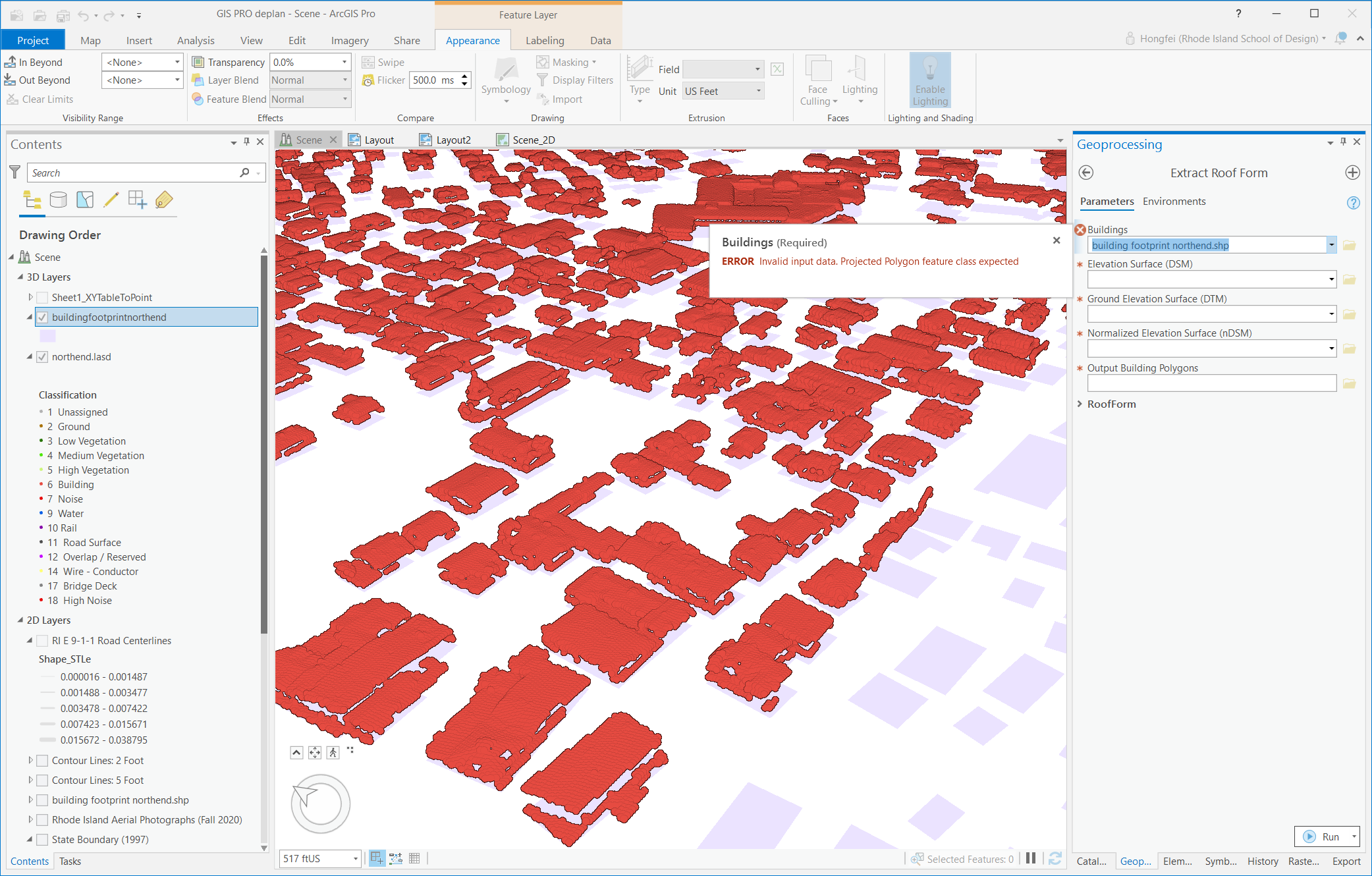
Hi, I try to use the Extract Roof Form tool with the city GIS website's footprint shp file, which I want to make into 3D. I already run the process to generate the DSM, DTM, and nDSM, but it has an error unable to use the building footprint and go next. How I should do?
Is all the footprint file must generate by Lidar data? Or there is something wrong with my building footprints data?
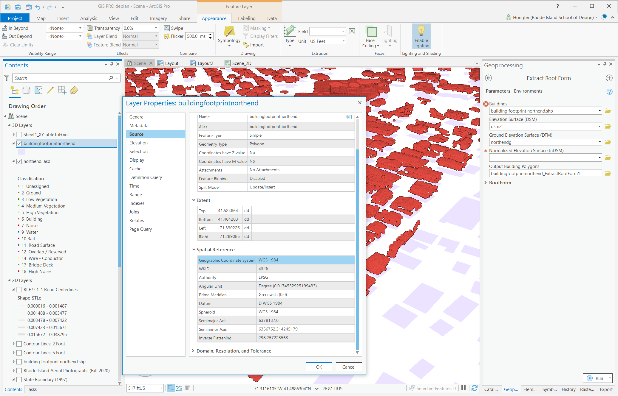
I noticed the building footprint is using WGS 1984. Is it the main problem that causes it doesn't work? If it is, how to convert that into projected polygon?
Building footprint sources: https://www.rigis.org/datasets/building-footprints
Thanks