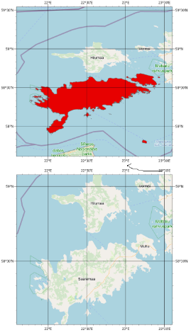
Hello, in ArcGIS Pro I have two separate maps with default OpenStreetMap basemaps. The default coordinate system is WGS84. If I import a shapefile into one map the coordinates stay the same but the projection changes. How can I change it back to default?
Please look at the picture.
Thanks!