I upgraded an existing Angular app to version 4.18 of ArcGIS Javascript from 4.14 and have experience an issue with the refreshing of FeatureLayer with the new version.
The app contains a FeatureLayer that is created with client side graphics. This layer uses a unique value renderer. Based on some user interaction, an attribute in the feature layer is updated which results in a different symbol being displayed.
The issue is that the symbol is now cut off (see image below). It appears that the FeatureLayer uses a tile system and it only updates the dirty tile. The issue is that the symbol goes beyond the dirty tile. The symbol appears after the user zooms in or out.
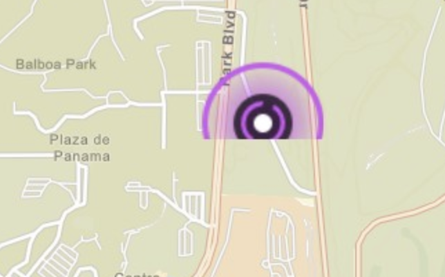
Any known solutions to this behavior? Such as expanding the dirty area?
Thanks,
Scott




