Hello,
I have a 10m DEM that I need to create a flow accumulation raster from. So I did the following: 1) filled sinks using "FILL" tool; 2) ran "FLOW DIRECTION" on the filled raster; 3) ran "FLOW ACCUMULATION" on the flow direction raster.
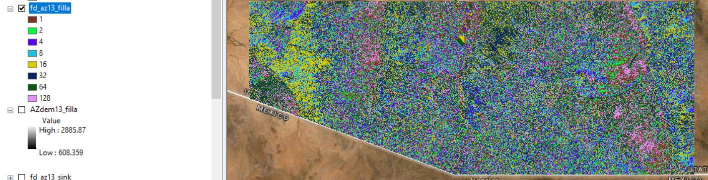
The flow accumulation raster seems wrong as it is mostly all one color (one value) and does not show any streams. I believe this is due to my flow direction raster which is highly pixelated (see below), although the values do make sense (2, 4, 8....).
In my experience, flow direction outputs have larger polygons and dont look as "speckled".
Any insight? I am using ArcMap 10.8