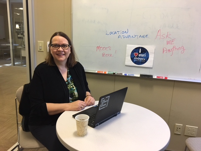
Evenementdetails:<\/STRONG><\/SPAN><\/P>Wat: <\/STRONG>Doe mee met instructeur John Shramek, cursusgastvrouw Linda Peters en Education Manager Joseph J. Kerski, Ph.D., GISP voor een AMA (Ask Me Anything) live op de GeoNet Community in de Location Advantage MOOC groep<\/A>. Stel de panelleden alles wat je wilt weten over de onderwerpen die in de cursus aan bod komen en alle leuke, interessante en tot nadenken stemmende vragen. <\/SPAN><\/LI>Wanneer:<\/STRONG> Het AMA-evenement vindt plaats in deze discussiedraad (rechtstreeks op deze pagina!) op donderdag 30 november 2017 van 12:30 tot 13:30 PT.<\/STRONG><\/SPAN><\/LI><\/UL> <\/SPAN><\/P>Hoe deel te nemen:<\/STRONG><\/SPAN><\/P> Tijdens de AMA, als je bent ingelogd op GeoNet (hier lees je hoe je kunt inloggen<\/A> met je Esri-inloggegevens), kun je je vragen plaatsen in de reacties hieronder en zullen de panelleden je vragen beantwoorden in de reacties. <\/SPAN><\/LI>Je kunt ook voorafgaand aan de AMA vragen plaatsen, maar we beginnen pas met antwoorden zodra de AMA begint op 30 november om 12:30 PT.<\/SPAN><\/LI><\/UL> <\/SPAN><\/P>Herinnering: AMA Tips en GeoNet Community Richtlijnen<\/STRONG><\/SPAN><\/P> Je hebt een GeoNet-account<\/A> (gebruikt Esri-inloggegevens) nodig om vragen te kunnen stellen. Als je nog geen Esri-inloggegevens hebt, regel die dan meteen; het kan een dag of twee duren om het verzoek te verwerken.<\/SPAN><\/LI>Bij het stellen van vragen en het maken van opmerkingen tijdens de AMA, vergeet niet de GeoNet Community Richtlijnen<\/A> te volgen.<\/SPAN><\/LI>Tijdens de AMA zal deze discussiepaginaniet automatisch vernieuwen, dus vergeet niet deze pagina te verversen om nieuwe vragen, opmerkingen en antwoorden te zien.<\/SPAN><\/LI><\/UL> <\/SPAN><\/P>Je weet dat de AMA live is wanneer je hieronder een foto ziet met John, Linda en Joseph. Vanaf dat moment, vergeet niet de pagina te verversen om onze updates en nieuwe vragen en opmerkingen te zien. Bedankt dat je meedoet en we zien je donderdag!<\/SPAN><\/P> <\/SPAN><\/P> 12 :30 pm<\strong> - En we zijn live! Stel gerust je vragen!<\span>
1 :00 pm - We zijn halverwege, geweldige vragen! Blijf ze stellen!<\span>
1 :25 pm - Nog vijf minuten! Heb je leuke vragen voor Joseph of John?<\span>
1 :30 pm - Over tijd! We nemen ook je vragen aan tijdens deze bonus van tien minuten!<\span>
1 :40 pm - En dat is een einde! De live AMA is afgelopen maar Joseph, Linda en John blijven vragen beantwoorden zodra hun schema's het toelaten. Bedankt dat je meedeed en zulke goede vragen stelde!<\span>
I graduated with a Bachelor of Liberal Arts degree a few years ago. What advice would you give someone like me, who didn't specifically study Geography, on how they can get into the GIS field?
If I'm just opening a new small business (a small gym), what's the simplest way to take advantage of a tool like Business Analyst? How can I get the quickest return on investment?
Hi Heather. That is a great question. There are 2 main databases of GIS programs ... one is the Guide to Geography Programs in the Americas from www.aag.org - and the other is the list and map maintained by geotechcenter.org. I would say that you are already doing 1 key thing - being active in taking courses, like this MOOC. The other thing you can do is (1) go through some of the lessons on http://learn.arcgis.com and (2) explore some of the GIS tutorial books on www.esri.com/books. Then, I would say, be active on LinkedIn with the GIS groups, attend a F2F conference or two each year if you can such as a state event or the Esri UC, subscribe to scgis.org or a state GIS listserv, which are often filled with GIS positions, and also ... think about perhaps taking a certificate program in GIS offered by a community college or a university. I'll cut it off there but happy to fill in more details. --Joseph Kerski
Hi Heather,
Thanks for the great question. I didn't start out my career in GIS either, but once I understood the power I went back to to study GIS. There are many great online courses like this MOOC that can help you sharpen your skills. I would suggest you think about how you might like to apply GIS, look for a company that needs these skills and go market yourself! There is incredibly high demand for graduates who understand how to think spatially.
keep thinking spatial!
Linda
I am not sure if this is the right place to make questions but I am a business student. I am from Honduras. The Choosing the Right Location and Understanding customers sections were awesome but I wonder, ArcGIS and Business Analyst provides data for my country?
Hi Heather - I would say, GIS is often a field that is used to complement another career or industry. In other words, many people who use GIS wouldn't say it's their job, or even their field. It's great for applying to almost any other industry, from insurance to IT to oil & gas. So, you could take free or paid GIS courses, in person or online, at a college or other providers, and integrate it into your own career of choice. It, IMO, is more about getting the GIS Technician-level skills, and maybe a certification, than about needing to pursue another degree or something.
Business Analyst will allow you to better understand the market you want to open up in as well as the customer base. I would explore the data using the techniques learned in week 4 - know who your target customers are and how best to reach them.
Javier
You can look at Esri Demographics | Explore Data and see all the different types of data available.
We have data for over 100 countries and counting!
Javier, we have data in Business Analyst for over 135 countries. And, ArcGIS Online has millions of data layers, if you use the Add button in the map, and search 'ArcGIS Online'. In Business Analyst Web, click the country flag icon at the top right of the map, and change the country dataset to Honduras.
Adena, great question. Business Analyst can be used for very quick, dynamic analyses, or for more in-depth, long-term, trend analyses or similar as well. In Business Analyst Web you can use the Color-Coded Map to look at the differing levels of a single variable to quickly to get a look at the demographics or market characteristics of an area where you may be thinking of locating. Or, you can use Smart Map Search to filter and compare up to five variables. Use these to either decide on the best potential area to locate in, or look at the types of consumers who may live in the area you're already located, for marketing purposes.
Hi to all! I am a user from China and it's about 4:30 AM here.
My questions are
* could anyone hear or know about an example of using ArcGIS tools for social studying, as their data may be not as accurate as the economic data? In the discussion forum of the course, I saw many people's use are neighborhood oriented, not dealing with big data like labor statistics but in small scale. How will GIS tool make an impact on local communities?
* Usually in China, we as citizen see the governmental report in the compiled format with the rough numbers instead of detailed attributes of target areas, I am thinking of tracking them in lists of data, could you give me some pieces of advice in this kind of reversing engineering the data using ArcGIS tool?
What about tapestry segmentation if I wanted to know socioeconomic and demographic composition of a place? I mean, I am not really sure what methodology was used in order to get data, moreover, there are many places a bit forgotten here.
Javier - here is another link - that lets you browse country by country:
doc.arcgis.com/en/esri-demographics/
1- I have been using ESRI products for quite a while now. I wonder why ESRI keep multiplying separate applications such as Bathimetry, Business Analyst online...
2- Some Parts of the world have very little(resolution) if not coverage at all on some ESRI products. What steps are you taking to reduce the coverage divide?
Jia -
Thanks for the great question. I would suggest you look at the National Statistical Bureau website for China. Typically these agencies do have in different areas including population and housing, labor, unemployment and more.
You may have to do some work to compile this data for analysis, but it would let you study at sub-national levels.
Javier, Tapestry is a great dataset, but at the moment we only have it built out for the US. Esri invests a lot in collating great datasets like this, and we're working continually on improving coverage all over the world, so hopefully soon we'd have a similar product for Honduras. Without it, there is still census data for most countries to get insights on demographics and socioeconomics. Here's a link to the for Tapestry, scroll down just a bit to see links for the methodology:
Tapestry Segmentation—Esri Demographics | ArcGIS
Greetings Jean: Great question. The resolution and types of data vary widely around the world. I used to work at data gathering institutions (US Census Bureau, USGS, NOAA) and those agencies still exist, churning out data, but not every country has agencies like that, or if they do, the data is sold OR you have to pay royalties on it OR it is simply not releasable to data users. The good news is that there is an open data movement happening for about 10 years now that has resulted in more data being available now than ever, and Esri works actively with organizations to help them serve their data, and we host some in The Living Atlas of the World. We write about these issues on http://spatialreserves.wordpress.com every week. But - you are correct - there are still significant gaps and I suspect there always will be.
--Joseph Kerski
Which geographic region has the best coffee in your opinion? If you can provide lat/long too that would be great.
When you do that, please let me know how I can cooperate.
Louise - I have taught GIS in Kenya 2 x. The coffee and tea there is the best I have ever had. All those wonderful volcanic soils - so I then wrote a GIS-based lesson on best places to grow tea in Kenya. Here I am on a tea farm in Kenya - On a tea farm in Kenya - YouTube
Hi 嘉诚 朱, you're right it's often harder to find smaller, more local datasets than larger. But GIS can help a lot with local communities and efforts, like grant proposals or civic projects, just by showing where people live or what types of business exist in different areas. I don't have any advice on reverse engineering, or extrapolating specific numbers from rough numbers, but let me know if you learn anything else on it! Thanks for all of your great comments in class!
I have another question. I was reading that to maximize profits and optimize yields, we need to dedicate the right crops and equipment to the places where they can flourish. With Esri, I understand people can integrate high-resolution imagery, field observations, and real-time data feeds to understand how to make the most of limited resources. What else do you offer for anyone working in agriculture?
Javier - here is the Esri distributor in Honduras. I have not talked with them but i *have* talked with the people in Belize.
How can we determine the best soil for coffee or wheat? Not just soil, knowing if the location is fit. For instance, if I had land and wanted to cultivate either.
Hola Javier - I would start here: (1) GIS for Agriculture | Overview (2) Then look in the Esri Living Atlas of the World (3) CropScape - Cropland Data Layer - Data.gov and some other agriculture layers that we describe on http://spatialreserves.wordpress.com But you are correct - the use of GIS in agriculture goes way back to the 1980s with precision agriculture - and it is a KEY use of GIS even today.
https://community.esri.com/groups/livingatlas?sr=search&searchId=8c911fc2-b88b-4f18-b3d8-b01bf9c6cb66&searchIndex=0
Any advice for someone that would like to become a Photogrammetrist?
Starbucks uses our technology to manage its coffee. Representative spoke at the 2014 User Conference. Esri UC - Starbucks Coffee and IT - YouTube
Adena
Javier, check out this video on CGIAR (Consultative Group on International Agriculture Research):
CGIAR | Computerworld
Other than that, there are definitely ways that Esri can help maximize agriculture returns:
GIS for Agriculture | Precision Agriculture
I've also heard that UAVs (or, drones), are being used a lot more in pinpointing what crops to plant where and how crops are faring.
I think the Best coffee in the world is from the Highlands of Cameroon. Its arôme is unique. .
Hello Javier,
There is a soil agriculture exercise in our Earth Imagery at Work MOOC that illustrates one way to use imagery data to explore yields. If you've not taken that course you might want to put it on your list. We will offer it in February 2018.
I will make it a bit more complex, how can someone have a wheat field or coffee field without deforesting? And at the same time produce energy, for instance, eolic in order to make flour in about 40 acres of land? Would a windmill be a good idea? A windmill producing energy and generating energy?
Heather, Dr. Kerski just posted this link, from the Dept. of Labor:
17-1021.00 - Cartographers and Photogrammetrists
There's also ASPRS, which is pretty active, and has local chapters. Contacting them and getting involved or even just learning from their websites will help:
ASPRS – IMAGING AND GEOSPATIAL SOCIETY
I'll follow up later if I think of more!
Jean - thanks for the coffee tip! --Joseph
Where Can I have a complete bathymetric data of the Gulf of Guinea.
Which organisation provide Esri Basemap with the ocean Data of this area?
Thank you. Sure I will.
Well, not sure if you could have crops and a windmill while leaving the forest there, but I'm not an agriculture expert. I'd think your best bet is to find local experts to consult with, who know the area, the soils, the topography, etc. Or just ask someone in the area already growing crops.
Jean - we do have the Esri Oceans Data - here - Visualizing Bathymetric Data Using the Esri Ocean Basemap | ArcWatch and the Ecological Marine Units new data set Ecological Marine Units - will these help?
I haven't done any programming in javascript on ArcGIS platform, but for other map services like Google and Baidu using iOS, each services using different imagery database, any guide on integrating those map services in mapping or reuse dataset from those map services?
Thank You I will check these links at the End of AMA.
Hi Jia!
I've got good news about not being a programmer! We have some great tools to build apps that don't require it! I invite you to take our DIY Geo Apps MOOC.
I don't think you can really combine map services, they're separate and make individual maps. But, you can use the ArcGIS API for Javascript to add many map services. Then you can control which one appears "on top", which one is used to cover different areas, etc.
Jia - our colleagues created these labs for developers to dig into the tools - I've seen these being taught and they are quite good - perhaps these will be helpful - Get Started with ArcGIS DevLabs | ArcGIS for Developers - Joseph Kerski
I am not far. Thank you for this!
Jia, right now its about 4:30 P.M. here:
I just really want to know if you have ever wondered how to make the same but at a familiar level. If we studied a really small community with a population ranging from 100-200.
Hope I can try that, someday.
hi !
I missed the live Q and A session but I am reading it now and find it so interesting and informative .
I have one question about teaching of GIS at school level. Can I find the data regarding number of schools /colleges in USA where GIS taught as a subject?
Thank you so much
Great question! I'm going to ask that Joseph Kerski respond.
That number as you may suspect is really difficult to get a handle on. The AAG Guide to Programs in geography on www.aag.org will give you an idea of the number of universities where Geography is taught. For GIS programs, see http://geotechcenter.org and the list of programs and map (ArcGIS Online!) there. For K12 schools, aside from the Geospatial Semester in Virginia, the EAST program in Arkansas, and a handful of other K12 schools in the USA and globally, there are very few GIS courses per se. GIS though *is* beginning to be more heavily used to teach STEM, history, geography, and so on, particularly with the advent of ArcGIS Online. Here is one of my articles on this subject http://www.josephkerski.com/kerski_jog_implementation_effectiveness.pdf See this story map to get a sense of in the USA which schools have a ArcGIS Online organizational subscription - not necessarily using it but at least 1 step forward:http://www.arcgis.com/apps/MapSeries/index.html?appid=c369c6d9bb6d4232bb3ad066cd5b9280 For years I served on the GENIP board and will try to find out where that project lives now online - it was a geography education in K12 national effort. Here is an article that might help:http://gato-docs.its.txstate.edu/jcr:42d98ff7-42d2-418c-b14a-55f288f9d99c/State_of_Geography_Report.pdf There is a story map that gives an indication of the strength of geography state-by-state on Home the GENIP page http://genip.weebly.com as well. I hope this helps. Great question. We are all trying our best to nudge the needle forward on geography and GIS education globally with the help of many partners.
Sorry for the delay with questioning/replaying. I'm more interested in Esri GIS applications applied to utilities (water/electric/gas/etc.). I have only one question: does any Esri GIS application (desktop or on-line) has dimension tool so that I can put needed dimension on a map? (please reply to vgkogut@chesterwater.com as well)?
I also want to mention that for me the most complex issue so far (was and still is) the existing project's files management (searching/renaming/modifying/deleting/etc.) as well as deploying those files both from ESRI and from anywhere else. Need to more time to learn, hope it has on-line help.
And general impression from Esri's ArcGIS-Online Platform is very good. Combining (as I understand, please correct me if I'm wrong) private and public clouds in one application with all typical ArcGIS tool involved seems very promising. Thank you for the course!
Hello Vladimir,
Thanks for the input. Please note that The Location Advantage MOOC is not designed to teach you how to use software, but to introduce how spatial analysis can benefit a variety of business challenges. Esri and others provide instruction on how to use specific software. Esri training courses (some free, some fee, some online, some face to face) are listed here.
Vladimir,
You can learn about Esri product support for dimensioning in these places.
ArcGIS Pro: Dimensions in ArcGIS Pro—Dimensions | ArcGIS Desktop
ArcMap: The dimension construction tools—Help | ArcGIS for Desktop
Thank you Adena,
"Esri training courses (some free, some fee, some online, some face to face) are listed here" - "here" link is broken or incorrect. Please repeat.
Also one more question: Is it possible to create .mxd file in ArcGIS/ArcMap and then "transfer" it into ArcGIS-Online Web Map Application platform? In other words is there a way to transform/publish .mxd file to ArcGIS On-line as Web Map application (if I'm not mistaken the other way around is possible)? Thank you.
Yes, you can publish a map in ArcMap, as a map service, a service definition file, a map package as a file, or a map package as a service. Click the File menu and go to Share As -> Map Package, and choose the option to upload it to the ArcGIS Online (or Portal) organization that you're logged into. You're also correct that you can choose in ArcGIS Online to open a map in ArcGIS Desktop.
As for the link, I'll let Adena repeat it, it may have been https://www.esri.com/training/ that she intended to share but I'm not sure.
Thanks!
John
Sorry - I fixed the link.
I appreciate this candid reply.
I will like to know if you offer online masters in GIS relating to business location in ESRI. Thanks
Step 11: Calculate field contents: this is my next stage of section 6. i have a challenge with a step before this. I realize that I cant add new layer of the Highest Risk Zone Policyholders table. Kindly assist me. Am limited by time, tomorrow is the deadline. Thanks.
Jian HuangKaran LalaKrishna Gummuluri1_ananse
Step 11: Calculate field contents:
I followed the instruction manual strictly. I realized the result keeps failing after calculation. Kindly assist in how to resolve this. Thanks.
Krishna GummuluriCollin Welbons_lala
I was able to resolve it
Hi, sorry for the delay; we don't have any master's degrees at this time. You'd need a college or university for that. Try:
Penn State
https://www.worldcampus.psu.edu/degrees-and-certificates/geographic-information-systems-gis-masters/overview
U of Colorado
Master Engineering GIS Online Degree | Online Master Degree in Engineering and Online Master of Engineering Courses | Un…
U of Wisconsin
About the Online Master’s Program in GIS & Web Map Programming – GIS Professional Programs at UW-Madison
Or look online for other ideas and lists, such as this one:
Best Buys: The 6 Most Affordable Online GIS Master's Programs
Good luck!
Aangemelde leden kunnen berichten plaatsen, updates volgen en meer. Nieuw hier? Registreer een gratis account.
Find useful guides, FAQs, and documents to help you navigate and make the most of Esri Community.