Did you miss our September 12, 2023 Survey123 Tricks of the Trade session? No worries. We recorded it for you!
Highlights
Imagine having thousands of ready-to-use layers and maps for use with ArcGIS. That is ArcGIS Living Atlas of the World! Watch this session to learn how you can leverage ArcGIS Living Atlas in Survey123:
- To make your survey maps more compelling
- To auto-calculate questions in your forms
- To create dynamic lists
Recording
Slides
Click here to download.
Q&A
Coming soon!
- What type of Living Atlas content is available for use with Survey123? It depends on what you want to do. If you want to configure your Survey123 map, then you can use web maps as well as any layer that can be added into a web map (feature layers, image layers, tiled layers...). For calculations and dynamic lists, you can only use feature layers and map services with feature access enabled (query). Scene layers, image layers or tiled layers are examples of content you cannot use in calculations or dynamic lists.
- Do Living Atlas layers consume credits? Generally, no. Almost every map and layer in the Living Atlas is either shared public by the Esri user community or requires a subscription (ArcGIS Online account) but does not consume credits. The Living Atlas does include a small collection of Premium Content items that consume 10 credits per 1,000 map requests and will have a Premium badge as seen below.
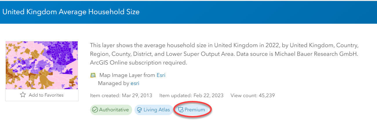
While it is possible for you to add Premium Content to a web map, and then use that web map in your survey, you will not be able to configure geo-calculations or dynamic lists against Premium Content using the Survey123 web designer. If you want the web designer to make Premium content available, add a comment below.
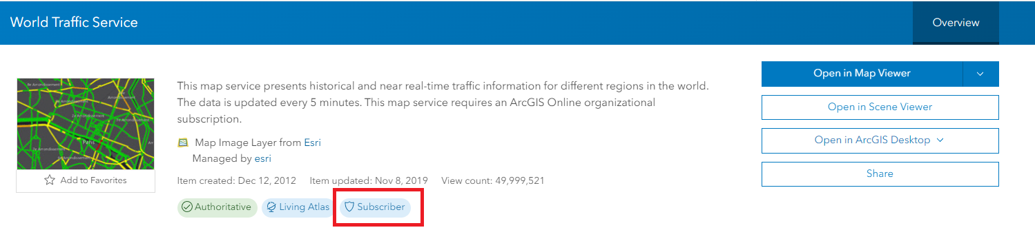
- If I use Living Atlas layers in my survey, can I share my survey publicly? Most layers you will find in the Living Atlas are free to use and can be included in publicly shared surveys. It is good practice to carefully read the Terms of Use for each item you use as some content owners have specific requirements such as attribution. There are, however, a number of layers in the Living Atlas that require an ArcGIS account. This is what is typically described as 'subscriber content'. Subscriber content does not consume credits but access always requires an account. If your survey includes subscriber content, you will not be able to share the survey publicly.
- Can I use Living Atlas content in Survey123 while offline? No. Some content owners allow you to download the data. You could then use the downloaded data in ArcGIS Pro to create a mobile map package... but that would only help you display a map while offline. Dynamic lists or geo-calculations only work against online layers.
- Can I change the contents of my Survey123 map based on choices in my survey? No.
- I like the concept of geo-calculations and populating a list from an ArcGIS Living Atlas layer. Can I use the same technique with non-Living Atlas layers? Yes. You can configure geo-calculations and dynamic lists against layers from ArcGIS Online and ArcGIS Enterprise (including multi-user geodatabase layers). Just make sure the layer as query capabilities enabled.
- Can I make the map zoom to a location based on a calculation? You can, but when you do, you will be setting the value of the map.
- Can I concatenate content from two fields in a Living Atlas layer and display that in a text field or note? Yes. Review the Geo-Calculations demo for the details.
- Can I create a dynamic list using the select_multiple (checklist) question type? With Survey123 Connect, you can!



