Hey there!
I am having an issue in modelbuilder that I cannot quite work my head around. I have many aerial photos of the same region over time. There are slight differences between the photos but I am using the same training samples for each classification. I have about 60 photos and I will be doing this for multiple areas so I wanted to create a model.
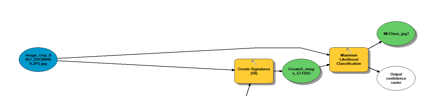
I have done this without the use of iterators but the model becomes impossibly large and incredibly time consuming to produce or change but it was sucessful. Here is an image of what I am trying to do without iterator:
Here is what I have come up with using a Raster iterator.
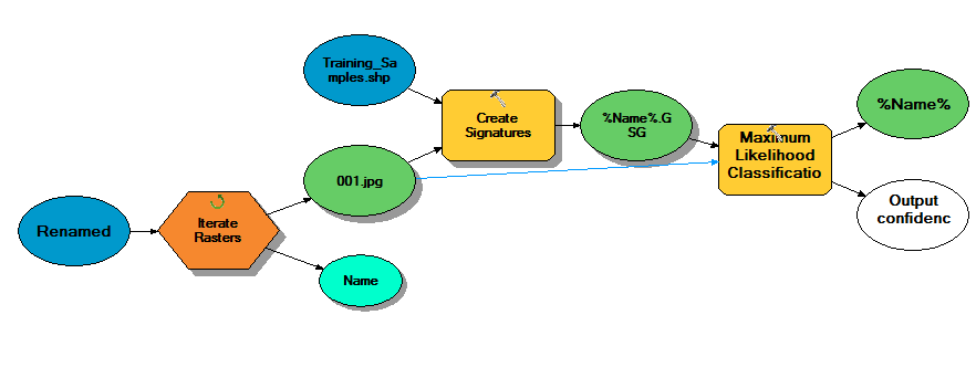
I cannot determine why this is not working when using the iterate raster function. It is essentially doing the same thing as the top image. The iteration works fine when I remove the maximum likelihood classification tool. When this tool is removed it creates a signature file for each raster in the selected workspace.
Anyone have any ideas what I am missing?
Thanks!
-Andrew



