I want to create a spatial view that draws a buffer around my input features, like this:
<SPAN class="keyword token">SELECT</SPAN>
<SPAN class="number token">a</SPAN><SPAN class="punctuation token">.</SPAN>OBJECTID<SPAN class="punctuation token">,</SPAN>
sde<SPAN class="punctuation token">.</SPAN>st_buffer <SPAN class="punctuation token">(</SPAN><SPAN class="number token">a</SPAN><SPAN class="punctuation token">.</SPAN>SHAPE<SPAN class="punctuation token">,</SPAN> <SPAN class="number token">33</SPAN><SPAN class="punctuation token">)</SPAN> <SPAN class="keyword token">as</SPAN> SHAPE
<SPAN class="keyword token">FROM</SPAN> schemaname<SPAN class="punctuation token">.</SPAN>tablename <SPAN class="number token">a</SPAN>
<SPAN class="keyword token">WHERE</SPAN> OBJECTID <SPAN class="operator token">IS</SPAN> <SPAN class="operator token">NOT</SPAN> <SPAN class="token boolean">NULL</SPAN><SPAN class="line-numbers-rows"><SPAN></SPAN><SPAN></SPAN><SPAN></SPAN><SPAN></SPAN><SPAN></SPAN></SPAN>
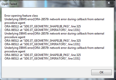
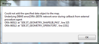
I get the following errors:
Any ideas what the problem could be?
Geodatabase version 10.3; Oracle version 12.1.0.2. Configured according to this doc.


