I want to calculate the total flow in an administrative area which is independent of the basin boundaries. I used the DEM file from HydroSHEDS and so far I have followed these steps:
1. Spatial Analyst -> Hydrology -> Fill
2. Spatial Analyst -> Hydrology -> Flow Direction
3. Spatial Analyst -> Hydrology -> Flow Accumulation
4. Spatial Analyst -> Math -> Logical -> Greater Than
5. Spatial Analyst -> Hydrology -> Flow Length
6. Spatial Analyst -> Hydrology -> Stream Link
7. Spatial Analyst -> Hydrology -> Stream Order (Strahler)
8. Spatial Analyst -> Hydrology -> Stream to Feature
The figure below shows the results of my work. Red lines are watershed boundaries and yellow lines are administrative zone boundaries. There are more than 80 zones. I have highlighted one of them for better visuals.
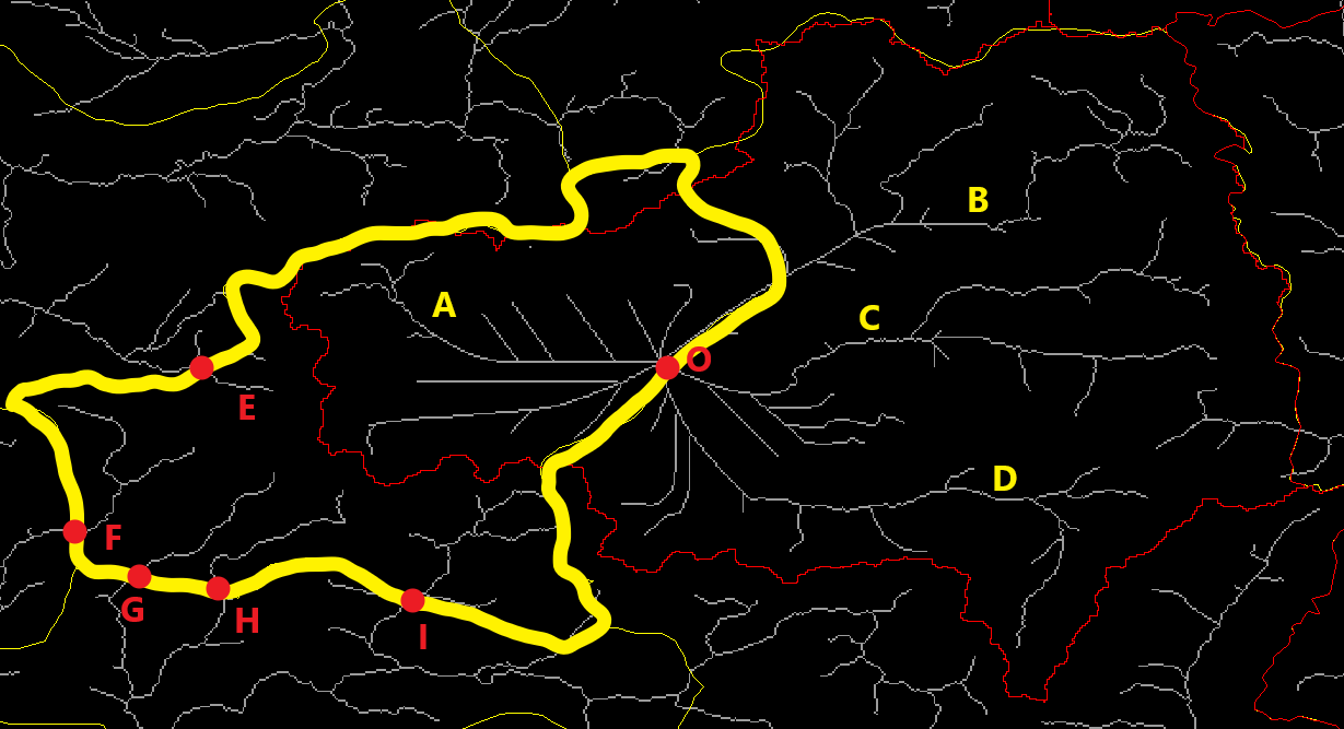
Now since I know the total amount of water available in a watershed (flow measurements), I want to estimate the relative amount of water accumulating in each of these administrative zones.
Flow accumulation already calculates a value at point O. If I can calculate the relative share of A, B, C and D, I can calculate the amount of water stream A accumulates. However, I still need to calculate the accumulation at points E, F, G, H and I, which are from another watershed, in order to calculate the total amount of water in the yellow zone. A piece of information such as 40 grids flow into point O from point A and 50 grid flow into point O from B+C+D is enough for my needs. And for the other basin the accumulations in E+F+G+H+I relative to that basins flow grids.
Is there any automated way to calculate these values?


