Currently with ArcGIS's open data website you are able to publish data and download data with local projections. For our site, this feature is "kind of" working. I say this because the data being uploaded to ArcGIS for server is in one local projection (NAD_1983_HARN_StatePlane_Florida_East_FIPS_0901_Feet) and when downloaded from our ArcGIS open data site a different projection (NAD83_HARN_Florida_East_ftUS) is used. Althought techincally they are both Harn Florida State Plane, they are slightly different (NAD_1983_HARN_StatePlane_Florida_East_FIPS_0901_Feet is EPSG: 85 while NAD83_HARN_Florida_East_ftUS is EPSG: 2881). It seems that the difference between the two projections is precision in the False Easting as well as point of origin as stated on Home -- Spatial Reference.
Is it possible that there is a change of projection occurring between the uploading to the server (to web mercator?) or that ArcGIS open data does not currently handle all local projections?
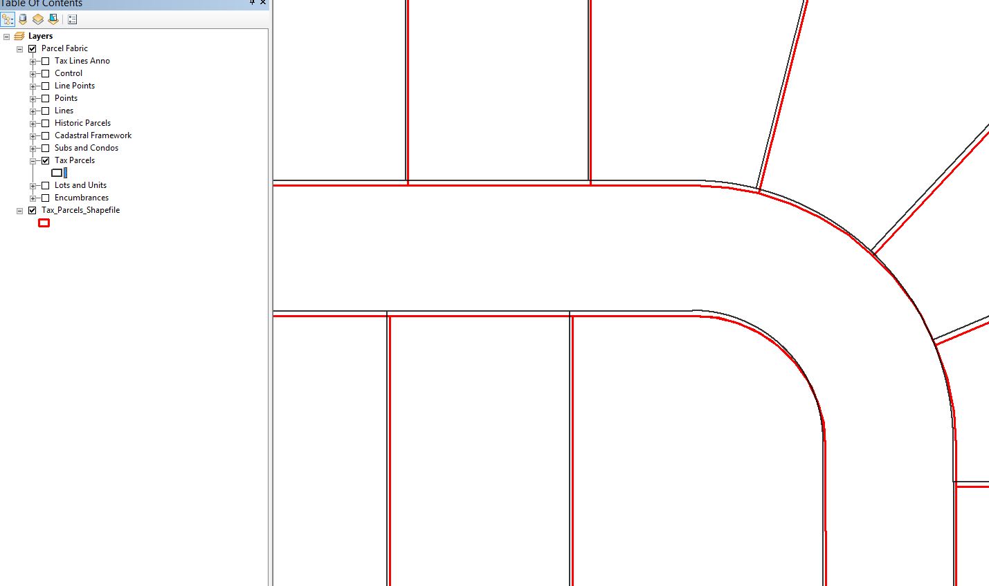
See the attached image for the example of change is data from SDE (fabric) to data downloaded from the open data site
(tax_parcels_shapefile).
Tax_Parcels_Shapefile = NAD83_HARN_Florida_East_ftUS
Tax Parcels Fabric = NAD_1983_HARN_StatePlane_Florida_East_FIPS_0901_Feet