I have a AutoCAD drawing, containing AutoCAD blocks with different definition. each block contains attribute tags. When I directly add AutoCAD drawing in ArcGIS Desktop 10.5 or ArcGIS Pro 1.3, it creates separate feature class for each block on the fly in Add data dialog box or catalog window.
as shown in following snapshot all the blocks are separated as manhole, splitter, splice and terminal box feature classes since they are different AutoCAD blocks with different block name and definition.
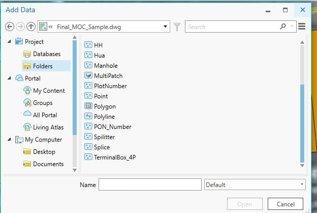
however, in ArcGIS 10.3 all the AutoCAD blocks are shown as a single Point feature class and its attribute fields were appended to its attribute table in case they are different.
Kindly review the snapshot of same data in ArcGIS Desktop 10.3 Add data dialog box.

in previous case it is very annoying to add all the blocks as separate feature layer in ArcMap. off course it also provides common point feature class but it does not contain block tag attributes.
So is there any setting to change this or what is the issue with the ArcGIS Desktop 10.5 or ArcGIS Pro to read CAD data?
any help in this regards is highly Appreciated. Thank You!
.



